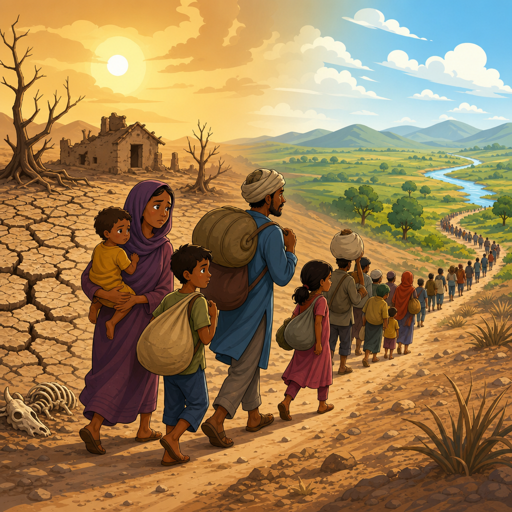
Deforestation is one of the clearest human drivers of flood risk, and understanding that link is essential for anyone studying floods and droughts as connected environmental disasters. In simple terms, deforestation is the removal of trees and forest cover faster than the land can recover its original ecological function. Flood risk is the likelihood that rainfall, river flow, storm surge, or rapid runoff will overwhelm natural or built drainage systems and damage people, property, infrastructure, and ecosystems. When forests are cleared, the water cycle changes: interception drops, infiltration often declines, soils compact or erode, stream channels destabilize, and downstream communities can face faster, higher, and dirtier floodwaters.
This matters because floods and droughts are not opposites in isolation; they are often symptoms of the same damaged landscape. In watersheds where I have reviewed land-use change maps and post-storm damage reports, the pattern is consistent. Hillslopes stripped for logging, pasture, mining, roads, or poorly planned agriculture produce flashier runoff during heavy rain, yet those same areas often store less moisture for dry periods. The result is a hydrologic double penalty: more severe flooding in wet conditions and lower baseflow during dry seasons. That is why this article serves as a hub for floods and droughts within the broader environmental disasters topic. To understand flood disasters well, you need to see how forest loss affects rainfall partitioning, groundwater recharge, river behavior, sediment loads, dam operations, urban drainage, and community vulnerability across an entire catchment.
Forests act like distributed water-management infrastructure. Their canopies intercept rainfall, roots create pathways for infiltration, leaf litter cushions soil from raindrop impact, and undisturbed soils store water that later feeds springs and streams. Not every forest prevents every flood, and not every clearing causes disaster. The scale, location, soil type, slope, rainfall intensity, road density, and downstream development all matter. But the central principle is settled: removing forest cover usually increases runoff speed and sediment movement, especially in steep or degraded basins. That raises the probability of flash floods, river flooding, debris flows, and infrastructure failure. It also weakens drought resilience because less water is retained in soils and shallow aquifers. For policymakers, planners, insurers, and residents, the key question is no longer whether deforestation influences flood risk, but where, by how much, and what interventions deliver measurable risk reduction.
How Deforestation Changes the Flood and Drought Cycle
The most direct mechanism is the loss of interception and evapotranspiration. A forest canopy captures part of a storm before it reaches the ground, and some of that moisture evaporates back into the atmosphere. When land is cleared, more rain hits the soil surface immediately, often with greater kinetic energy. If heavy machinery, cattle, repeated burning, or road building have compacted the soil, infiltration capacity can fall sharply. Water then moves as overland flow instead of soaking in. During high-intensity storms, that runoff reaches streams faster, causing shorter lag times between rainfall and peak discharge. In hydrology, this creates a flashier hydrograph, meaning higher peaks over a shorter period.
The drought side of the cycle is just as important. Forest soils with organic matter and root channels can store substantial moisture, release it gradually, and support groundwater recharge. After clearing, especially when replaced by shallow-rooted pasture or exposed ground, dry-season streamflow often declines. Springs can become less reliable, and rivers that once carried steady baseflow become more variable. In practice, I have seen communities misread this as a rainfall problem alone when the deeper issue was watershed degradation. Deforestation can therefore make wet seasons more destructive and dry seasons more stressful, creating a costly pattern for agriculture, drinking water systems, and hydropower.
Scale determines impact. Small selective logging in a low-slope basin with intact riparian buffers may produce limited measurable change, while large-scale clearing in steep tropical catchments can transform flood behavior within a few seasons. Roads are often the hidden multiplier. Poorly drained logging or access roads intercept subsurface flow, concentrate runoff, and deliver water and sediment directly into channels. In many flood investigations, the road network explains as much damage as the loss of tree cover itself. That is why flood and drought analysis must look beyond forest percentage alone and assess land-use configuration across the whole watershed.
Why Forest Loss Increases Flood Peaks
Flood peaks rise when more water arrives at the channel at the same time. Deforestation encourages that synchronization by removing roughness, reducing storage, and creating direct flow paths. On steep terrain, raindrop impact breaks apart bare soil, forming surface crusts that further reduce infiltration. Rills and gullies then evolve, draining slopes efficiently during storms. Channels receive runoff faster, and if the floodplain downstream has been narrowed by development, embankments, or sediment deposition, water levels climb even more. The effect is especially pronounced in headwater basins that feed communities in valleys and deltas.
Sediment amplifies the hazard. Tree roots stabilize slopes and riverbanks; when vegetation is removed, erosion rates increase. Sediment can aggrade streambeds, reducing channel capacity, or clog culverts and storm drains, causing localized flooding far beyond the cleared area. After intense rainfall, hillslope failures may add woody debris and boulders that temporarily dam channels. When those debris jams fail, they release surges of water and sediment downstream. This is one reason mountain deforestation is linked not only to classic river floods but also to debris floods and landslide-induced flooding.
Extreme storms complicate the discussion. During very rare, basin-wide downpours, even intact forests cannot prevent flooding entirely because soils can saturate and rainfall can exceed storage capacity. However, that limitation does not cancel the value of forest cover. In moderate and frequent storms, forests often reduce runoff volume and delay peak flow. In severe events, they still help by lowering erosion, stabilizing slopes, and reducing sediment blockage around bridges and culverts. Risk management should therefore treat forest conservation as one layer in a broader flood strategy, alongside zoning, early warning, drainage design, retention basins, and resilient infrastructure.
Watersheds, Rivers, and Real-World Flood Patterns
A watershed is the land area that drains to a common outlet, and it is the right scale for linking deforestation to floods and droughts. What happens upslope shapes what happens downstream. In tropical regions, rapid conversion of forest to cattle pasture, soy, oil palm, or smallholder agriculture has repeatedly altered river response. In the Amazon basin, researchers have documented how forest loss can change regional moisture recycling and increase local runoff. In Southeast Asia, upland clearing for plantations and roads has intensified downstream sedimentation and flood exposure in lowland communities. In parts of East Africa, montane forest degradation has been associated with flashier rivers and more variable dry-season flows.
The pattern also appears outside the tropics. After severe wildfires, which can function like abrupt deforestation in hydrologic terms, burned watersheds in the western United States often produce destructive post-fire floods and debris flows because ash layers and heat-altered soils repel water. In Central Europe and parts of the Balkans, illegal logging and slope disturbance have been implicated in localized flood disasters where small streams rose rapidly after heavy summer storms. The exact percentages differ by basin, but the lesson is stable: watershed condition controls hazard transmission.
For a hub page on floods and droughts, the practical takeaway is that flood risk should never be analyzed only at the town boundary. Upstream land cover, riparian integrity, wetland extent, reservoir operations, and channel maintenance all matter. If you are building deeper content under this hub, the key related topics include flash floods, river floods, urban flooding, post-wildfire flooding, drought propagation, watershed restoration, and nature-based solutions. Those subjects are connected by the same hydrologic logic: landscapes regulate how water moves, and degraded landscapes produce more volatile extremes.
How Experts Measure the Impact of Deforestation
Flood analysis is strongest when it combines field evidence with hydrologic modeling and remote sensing. In practice, analysts compare land-cover change using Landsat or Sentinel imagery, map slopes and drainage networks with digital elevation models, and then estimate runoff using methods such as the SCS Curve Number approach, unit hydrographs, or distributed rainfall-runoff models like HEC-HMS and SWAT. River hydraulics may then be tested with HEC-RAS to estimate how altered flows translate into flood depth and extent. No single model captures every process perfectly, but together they reveal whether deforestation is increasing peak discharge, shortening time to peak, or loading rivers with sediment.
Field indicators matter just as much as software outputs. Compacted skid trails, exposed subsoils, clogged culverts, new gullies, bank undercutting, and reduced litter depth are visible signs that a catchment is becoming flood-prone. During watershed assessments, I look closely at road drainage because concentrated discharge from ditches is a common trigger for erosion and local flooding. Community timelines are valuable too. Residents often know exactly when streams began rising faster, which crossings now fail first, and which springs became seasonal after nearby clearing.
| Indicator | What it shows | Common tools | Why it matters for floods and droughts |
|---|---|---|---|
| Forest cover change | Loss or fragmentation of canopy | Landsat, Sentinel-2, GIS | Signals reduced interception and altered runoff pathways |
| Soil infiltration | How quickly water enters the ground | Double-ring infiltrometer, field tests | Low infiltration increases flash flooding and lowers recharge |
| Peak discharge | Maximum river flow during storms | Stream gauges, HEC-HMS | Higher peaks increase overtopping and channel erosion |
| Sediment load | Amount of soil carried by water | Turbidity sensors, sampling | Reduces channel capacity and damages reservoirs |
| Baseflow | Dry-weather contribution to streams | Hydrograph separation, gauges | Declining baseflow signals weaker drought resilience |
Good measurement also acknowledges uncertainty. Rainfall variability, geology, antecedent moisture, and reservoir operations can mask or magnify the influence of forest loss. That is why robust studies compare multiple storms across multiple years rather than attributing a single flood to one cause. Even so, where clearing is extensive and slopes are sensitive, the signal is usually strong enough to guide policy with confidence.
Reducing Risk Through Forest and Water Management
The best way to reduce flood risk from deforestation is to manage the watershed before disaster strikes. Protect remaining natural forest in steep headwaters, along riparian corridors, around springs, and on erosion-prone soils. Enforce road drainage standards for logging, mining, and rural access routes. Require culverts sized for local design storms and maintain them before rainy seasons. Restore degraded slopes with native species, mulch, contour planting, check dams, and controlled grazing. Reconnect rivers to floodplains where possible so high flows can spread safely instead of accelerating through constrained channels.
Restoration works best when it is targeted. Not every hectare produces the same benefit. A narrow riparian buffer upstream of a vulnerable settlement may reduce bank erosion and sediment delivery more effectively than broad planting in a flat area with low connectivity to the stream. Wetlands deserve special attention because they store water, filter sediment, and sustain dry-season flows. Payment for ecosystem services, water funds, and watershed protection fees can help finance these interventions, especially where downstream utilities or industries depend on reliable water supply.
Communities should also pair landscape measures with conventional flood and drought planning. Update floodplain maps, restrict high-risk development, install rainfall and river gauges, improve evacuation routes, and diversify water sources for dry periods. Forest conservation is not a substitute for engineering, but in my experience it makes engineering more reliable by reducing sediment, slowing runoff, and protecting source water. The durable lesson for floods and droughts is straightforward: healthy watersheds moderate extremes, while deforested watersheds magnify them. If you are planning resilience work, start upstream, map the whole catchment, and treat forest cover as critical risk infrastructure.
Deforestation increases flood risk by accelerating runoff, weakening soils, loading rivers with sediment, and reducing the landscape’s ability to store water for dry periods. That single change in land cover can ripple through the entire hydrologic system, from hilltops and headwater streams to reservoirs, urban drains, farms, and downstream settlements. As a hub for floods and droughts, this topic reveals why environmental disasters cannot be managed one hazard at a time. The same watershed degradation that raises flash-flood peaks can also reduce groundwater recharge, lower baseflow, and intensify drought stress months later.
The most useful way to think about floods and droughts is as linked outcomes of water mismanagement across a catchment. Forests, wetlands, riparian zones, and healthy soils are not optional amenities; they are functional assets that regulate flow, trap sediment, and preserve water security. The evidence from field assessments, satellite mapping, and hydrologic modeling points in the same direction: where forest loss is extensive or poorly managed, flood hazards usually rise and drought resilience usually falls. The strongest responses combine conservation, restoration, road and drainage controls, floodplain planning, and local monitoring.
If you want to reduce disaster risk, begin with the watershed that supplies your community. Identify where forests have been cleared, where runoff is concentrating, where sediment is entering channels, and which neighborhoods or farms are exposed downstream. Then connect that assessment to practical action: protect critical headwaters, restore riparian buffers, improve drainage maintenance, and build land-use policy around how water actually moves. Start there, and every other flood and drought decision becomes smarter.
Frequently Asked Questions
How does deforestation increase flood risk?
Deforestation increases flood risk by removing one of the landscape’s most important natural defenses against heavy water flow: trees and the forest floor. In a healthy forest, tree canopies intercept rainfall, branches slow the force of falling water, roots create channels that help water soak into the soil, and leaf litter acts like a sponge that stores moisture temporarily. When forests are cleared, those protective layers are reduced or lost. Rain reaches the ground more directly, the soil is more easily compacted or eroded, and less water infiltrates into the land. Instead, more of it moves rapidly across the surface as runoff.
That faster runoff can overwhelm streams, rivers, storm drains, and floodplains, especially during intense rain events. Deforestation also often leads to sediment washing into rivers, which can make channels shallower and less able to carry floodwater safely. In effect, forest loss changes both how much water flows and how quickly it arrives. This is why deforestation is widely recognized as a major human driver of flood hazard, particularly in river basins, steep slopes, and regions already exposed to heavy seasonal rainfall.
Why are tree roots and forest soils so important for preventing floods?
Tree roots and forest soils are central to flood prevention because they regulate the way water moves through a landscape. Roots bind soil together, helping maintain its structure and stability. That structure matters because well-formed soil contains pores and channels where rainwater can infiltrate rather than run off immediately. Forest soils also tend to contain organic matter from decomposing leaves, branches, and other plant material. This organic layer improves the soil’s ability to absorb and retain water, reducing the speed and volume of runoff during storms.
When forests are removed, the soil is often exposed to direct rainfall, machinery, grazing, or burning, all of which can compact the ground and reduce infiltration. Once soil loses structure, water is much more likely to skim across the surface instead of soaking downward. On sloped land, this process can be especially dangerous, as runoff accelerates quickly and can trigger flash flooding, erosion, and even landslides. Forest soils therefore do more than simply support plant life; they act as a living water-management system that buffers watersheds against sudden, damaging surges in flow.
Can deforestation cause both floods and droughts in the same region?
Yes, and this is one of the most important reasons deforestation is discussed in relation to floods and droughts as connected environmental disasters. Forests help moderate the water cycle over time. During rainy periods, they slow runoff and store water in soils and vegetation. During drier periods, that stored water is gradually released into streams, groundwater, and the atmosphere through evapotranspiration. This creates a more stable hydrological system with fewer extremes.
When deforestation occurs, that balancing function is weakened. Rainwater is less likely to be absorbed and stored, so more of it rushes away quickly, increasing flood risk in the short term. But because less water infiltrates the soil and replenishes groundwater, there may be less moisture available later, which can worsen dry-season water shortages and drought conditions. In some regions, large-scale forest loss can also affect local and regional rainfall patterns by reducing the amount of moisture recycled back into the atmosphere. That means deforestation can intensify wet extremes and dry extremes at the same time, making communities more vulnerable year-round.
Are some areas more vulnerable to deforestation-related flooding than others?
Yes, the effects of deforestation on flood risk are not uniform, and some areas are far more vulnerable than others. Mountain slopes, hilly watersheds, tropical rain regions, and places with intense seasonal storms are especially sensitive because water naturally moves quickly through these landscapes. If tree cover is removed in such areas, runoff can increase dramatically in a short period of time. River valleys downstream are also highly exposed, because they often receive the combined effects of faster runoff, higher sediment loads, and sudden surges in river discharge from upstream forest loss.
Urbanizing areas near deforested land can face even greater danger. When forests are cleared and replaced with roads, buildings, compacted fields, or other hard surfaces, the land loses even more of its capacity to absorb water. This can turn heavy rainfall into severe flash flooding. Communities with weak drainage infrastructure, limited land-use planning, or a history of settlement in floodplains are particularly at risk. In practical terms, deforestation-related flooding is most damaging where environmental vulnerability and human exposure overlap.
What can be done to reduce flood risk caused by deforestation?
Reducing flood risk caused by deforestation requires both protecting existing forests and restoring damaged landscapes. Preventing unnecessary forest clearing is often the most effective first step, especially in critical watersheds, river headwaters, steep slopes, and areas that buffer towns and farmland from runoff. Strong land-use planning, enforcement against illegal logging, sustainable agriculture, and conservation policies can all help maintain the forest cover that naturally reduces flood intensity.
Where deforestation has already occurred, reforestation and afforestation can improve long-term watershed function, though results depend on tree species, soil condition, topography, and time. Restoring native vegetation, stabilizing streambanks, rebuilding soil health, and managing grazing or road construction can also reduce erosion and slow runoff. In many cases, the best approach combines ecological restoration with engineered measures such as retention basins, improved drainage, floodplain zoning, and early warning systems. The key point is that flood management should not focus only on rivers after they rise; it should also address what is happening across the broader landscape, especially where forest loss has made water move faster and more destructively.