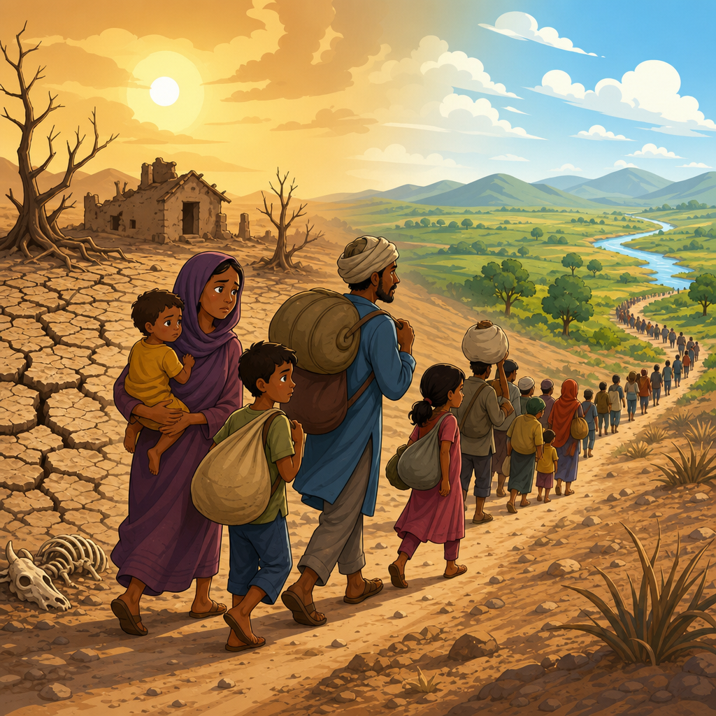
Floods happen when water overtops the land’s normal drainage capacity, while droughts develop when water supply stays below ecological, agricultural, or human demand for an extended period. As a hub for Floods and Droughts within the broader Environmental Disasters topic, this guide explains what causes floods, how natural and human triggers interact, why drought belongs in the same conversation, and which practical measures reduce harm. In field assessments after river floods and urban flash floods, I have seen the same pattern repeatedly: damage is rarely caused by rainfall alone. The real driver is a mismatch between water, land use, infrastructure, and preparedness. Understanding that mismatch matters because floods are the most frequent disaster globally, affecting millions each year, disrupting transport, contaminating drinking water, and causing long economic recoveries. Drought works as the hydrologic mirror image, stressing crops, reservoirs, soils, and power systems. Studied together, floods and droughts reveal how water extremes arise from the same climate system and the same management decisions.
In practical terms, a flood begins when precipitation, snowmelt, storm surge, dam failure, ice jams, or blocked drainage push water beyond channels, storage basins, or engineered defenses. A drought begins when rainfall deficits, high evaporation, heat, or overuse reduce available water for months or years. Hydrologists usually distinguish meteorological, agricultural, hydrological, and socioeconomic drought, because lack of rain does not affect every system at the same speed. Floods are classified by mechanism as riverine, flash, coastal, pluvial, groundwater, and compound flooding. Those distinctions matter because each type has different warning times, causes, and solutions. A coastal surge flood during a cyclone requires different planning than a sudden flash flood in a paved city catchment. Likewise, a short seasonal dry spell is not the same as a multi-year basin drought that lowers groundwater and reservoir storage.
Natural triggers of floods: rainfall, snowmelt, storms, and terrain
The most familiar flood trigger is intense or prolonged rainfall. When rain falls faster than soil can infiltrate it, excess water becomes surface runoff and moves into drains, streams, and rivers. In steep basins this can happen within minutes, producing flash floods with little warning. In large rivers, several days of widespread rainfall can raise water slowly but persistently until levees are overtopped. Soil saturation is critical. A moderate storm falling on already wet ground can produce worse flooding than a heavier storm after a dry period because the landscape has lost storage capacity. This is why antecedent moisture is tracked in forecasting systems from the U.S. National Weather Service to the European Flood Awareness System. River floods in the Mississippi basin, the Ganges-Brahmaputra-Meghna system, and central Europe have all been amplified by repeated storms over saturated catchments.
Snow and ice add another pathway. Rapid warming can melt mountain snowpack quickly, and rain falling on snow accelerates runoff because liquid water moves through the snow layer and releases more stored water into rivers. Ice jams create a different hazard: chunks of river ice accumulate at constrictions such as bends, bridges, or shallow sections, temporarily blocking flow. Water ponds upstream, then surges if the jam breaks. Topography controls how severe these events become. Narrow valleys concentrate flow; low-lying floodplains store overflow but also attract settlement because they are fertile and flat. Coastal plains are exposed to storm surge, especially when high tides and onshore winds coincide. In tropical cyclones, the deadliest water may not be rainfall but a surge pushed inland by wind and low pressure. Hurricane Katrina demonstrated how surge, levee failure, and settlement patterns can interact catastrophically.
Human causes of flooding: urbanization, deforestation, engineering, and poor planning
Human activity often turns a heavy rain into a disaster. Urbanization replaces absorbent soils and vegetation with roofs, roads, parking lots, and compacted ground, sharply increasing runoff volumes and peak flow rates. Storm drains speed water away from streets, but if the drainage network is undersized, clogged, or backed up by a swollen river, water accumulates rapidly. I have inspected neighborhoods where a single blocked culvert converted ordinary stormwater into house-deep flooding because the upstream basin had been paved over without detention storage. This is a common pattern in fast-growing cities across South Asia, Africa, and Latin America. Informal development in low-lying areas intensifies risk because housing often sits beside channels, on reclaimed wetlands, or at the foot of unstable slopes where floodwaters carry debris.
Deforestation and wetland loss also matter. Forest canopies intercept rainfall, root systems maintain soil structure, and wetlands act as natural sponges that slow runoff and store floodwater. Removing those systems reduces infiltration, increases erosion, and sends sediment into rivers, which can raise riverbeds and reduce channel capacity. Channelization and levees can protect specific places in the short term, but they may transfer risk downstream by moving water faster and removing room for rivers to spread safely. Dams are more complex. Well-operated reservoirs can reduce downstream flood peaks, yet poorly managed releases or structural failure can worsen inundation. Land-use planning failures tie these problems together. Building on floodplains without elevation standards, set-backs, retention basins, or updated flood maps is not bad luck; it is a policy choice that converts hydrologic events into predictable losses.
How climate change is altering flood risk
A warmer atmosphere holds more water vapor, roughly 7 percent more for every 1 degree Celsius of warming under the Clausius-Clapeyron relationship. That does not mean every place gets wetter all the time, but it does mean many heavy rainfall events can become more intense. Observational records and attribution studies increasingly show that climate change is raising the probability of extreme precipitation in many regions. Warmer oceans also provide more energy for intense storms, while sea-level rise lifts the baseline for coastal flooding, allowing surges to travel farther inland and causing nuisance tidal flooding more often. In mountain regions, earlier snowmelt shifts river timing and can raise spring flood potential. In wildfire-prone watersheds, burn scars reduce infiltration and make debris-laden flash flooding more likely after even modest rain.
Climate change does not replace local causes; it magnifies them. A city with undersized drainage, filled wetlands, and weak building controls will experience a larger jump in flood damage than a city that has protected floodplains, maintained culverts, and expanded stormwater storage. Compound events are especially important. High tide, storm surge, and extreme rainfall can occur together, trapping water because outfalls cannot discharge into the sea. During recent urban floods in places such as Jakarta, Lagos, and Miami, sea-level rise, subsidence, drainage limits, and intense rain all contributed. The policy implication is straightforward: climate adaptation for floods must combine emissions reduction with local risk reduction. Better pumps alone are insufficient if development continues in sinking, low-elevation coastal zones. Similarly, bigger levees are not enough if catchments upstream are being stripped of natural storage and floodplain access.
Why floods and droughts belong together
Floods and droughts are often treated as separate disasters, yet water managers know they are linked by the same hydrologic cycle. The same basin can swing from severe drought to damaging flood because dry soils can harden and lose infiltration capacity, while vegetation loss during drought can reduce interception and increase erosion when rain finally returns. Reservoir operators must balance conflicting goals: store water for drought security, but leave enough empty capacity to buffer floods. Groundwater overuse during drought can cause land subsidence, which then worsens flood exposure in delta cities. In agriculture, prolonged dry periods may encourage expansion of irrigation and drainage works that alter local runoff patterns. These are not isolated problems. They are connected expressions of water imbalance over time.
Drought itself has several forms. Meteorological drought is below-normal precipitation. Agricultural drought occurs when soil moisture is too low for crops and rangeland. Hydrological drought refers to reduced streamflow, reservoir storage, and groundwater levels. Socioeconomic drought appears when water shortages disrupt households, energy production, navigation, or industry. Standard tools such as the Standardized Precipitation Index, Palmer Drought Severity Index, soil moisture monitoring, and reservoir storage tracking help define severity. The lesson for a Floods and Droughts hub is simple: resilience comes from managing variability, not just reacting to one hazard at a time. Watershed restoration, aquifer recharge, efficient irrigation, and floodplain protection can reduce both flood peaks and drought stress when designed as part of one system rather than separate emergency programs.
Main flood types, causes, warning time, and typical impacts
| Flood type | Primary causes | Typical warning time | Common impacts |
|---|---|---|---|
| Riverine | Prolonged regional rain, snowmelt, reservoir releases | Hours to days | Floodplain inundation, crop loss, transport disruption |
| Flash | Intense rain, steep terrain, burn scars, urban runoff | Minutes to hours | High mortality risk, debris flow, road washouts |
| Coastal | Storm surge, high tide, sea-level rise | Hours to days | Saltwater intrusion, structural damage, erosion |
| Pluvial | Rainfall overwhelming drainage away from rivers | Minutes to hours | Street flooding, basement flooding, sewer backup |
| Groundwater | Persistent wet periods raising water table | Days to weeks | Long-duration property damage, septic failure |
| Compound | Multiple drivers such as surge plus rainfall plus river flow | Varies | Wide-area losses, emergency response overload |
How communities reduce flood and drought risk
Effective risk reduction starts with mapping and ends with maintenance. Hazard maps should combine historical records, topography, rainfall intensity data, river hydraulics, land use, and future climate assumptions. Tools such as HEC-RAS, SWMM, LiDAR terrain models, and satellite rainfall estimates have improved local planning, but the output is only as good as the assumptions and upkeep behind it. In practice, the best flood reduction programs blend structural and nonstructural measures: levees where justified, detention basins, restored wetlands, permeable pavement, elevated buildings, floodproofed utilities, warning systems, evacuation planning, and restrictions on new development in high-risk zones. The Dutch Room for the River program is a strong example of working with floodplains instead of trying to confine every river with ever-higher embankments.
Drought resilience uses many of the same principles. Protect catchments, improve soil organic matter, recharge aquifers, repair leaking distribution systems, diversify water sources, and use pricing or allocation rules that discourage waste without punishing basic household needs. Agriculture usually offers the largest gains through irrigation scheduling, drought-tolerant crops, and precise measurement of evapotranspiration. Communities should also plan for cascading effects: floods can shut down wastewater treatment, ports, and hospitals; drought can reduce hydropower, raise food prices, and intensify wildfire risk. Emergency planning must therefore include backup power, redundant water supply, public health surveillance, and clear communication. People do not need perfect prediction to act safely. They need credible warnings, understandable maps, and local infrastructure designed for the extremes that now occur more often than old averages suggest.
Floods are caused by a mix of natural forces and human choices. Heavy rain, snowmelt, storm surge, ice jams, and basin shape create the physical hazard. Urbanization, deforestation, wetland loss, poor drainage, floodplain development, and weak maintenance determine how destructive that hazard becomes. Drought belongs in the same discussion because the two extremes emerge from one water system and often intensify each other through land degradation, reservoir tradeoffs, and climate variability. If there is one lesson from decades of flood and drought management, it is that disasters are rarely pure acts of nature. They are usually the result of exposure and vulnerability meeting an extreme event.
For readers building their understanding of Environmental Disasters, this Floods and Droughts hub should serve as the foundation. Start with the mechanisms: know the flood type, identify the trigger, assess the land use, and examine the infrastructure. Then look at longer-term water stress, because a drought today can shape flood losses tomorrow. The biggest benefit of this approach is practical clarity. It turns a broad topic into decisions about zoning, drainage, watershed restoration, emergency alerts, reservoir rules, and household preparedness. Review your local flood maps, learn your evacuation routes, and support projects that give water more room instead of forcing every drop into a narrower channel. That is how communities reduce losses before the next extreme arrives and build lasting resilience for a drier or wetter future ahead.
Frequently Asked Questions
What is the main cause of flooding?
The main cause of flooding is simple in principle: more water arrives than the land, rivers, drainage systems, or soils can absorb, store, or carry away. In practice, that overload can happen in several ways. Intense rainfall is one of the most common triggers, especially when storms drop large amounts of water in a short period. Rivers can also flood after prolonged rain over a wide area, when upstream runoff keeps channels full long after the storm has passed. Coastal flooding may happen when storm surge, high tides, or strong winds push seawater inland. Snowmelt, ice jams, and sudden dam or levee failures can also rapidly raise water levels.
Just as important, flooding is rarely caused by nature alone. The severity of a flood often depends on land use and infrastructure. When forests are cleared, wetlands drained, floodplains built over, and cities covered with pavement, water runs off faster and has fewer places to go. Storm drains may be undersized, blocked, or overwhelmed. That means the “main cause” of flooding is best understood as an imbalance between incoming water and the landscape’s capacity to handle it. Natural weather events provide the water, but human decisions often determine how destructive the flood becomes.
How do natural triggers like heavy rain, snowmelt, and storms lead to floods?
Natural triggers lead to floods by increasing water input or slowing its normal movement through a watershed. Heavy rainfall is the clearest example. If rain falls faster than soil can absorb it, the excess becomes surface runoff. That runoff flows downhill into streams, rivers, streets, and low-lying areas. If the ground is already saturated from earlier rain, even moderate additional rainfall can produce flooding because there is little remaining capacity in the soil. In mountain regions, steep slopes can accelerate runoff and cause rivers to rise very quickly.
Snowmelt can create similar problems, especially when temperatures warm rapidly in late winter or spring. A sudden thaw releases stored water from the snowpack into streams and rivers, and if that thaw happens alongside rainfall, flood risk rises sharply. Frozen ground adds another complication because it reduces infiltration, forcing meltwater to run off rather than soak in. Ice jams can worsen river flooding when broken river ice piles up at narrow points and acts like a temporary dam, causing water to back up upstream and sometimes release suddenly.
Large storms amplify multiple flood mechanisms at once. Tropical cyclones and severe coastal storms can bring torrential rain inland while also producing storm surge along the coast. Thunderstorms can trigger flash floods when rainfall is intense and localized, overwhelming creeks and urban drainage in minutes or hours. Seasonal monsoons, atmospheric rivers, and long-duration low-pressure systems can flood entire regions by delivering repeated rounds of rain over days. In every case, the natural trigger is the event that loads the system with water, but the actual flood depends on terrain, soil conditions, river capacity, and how exposed people and infrastructure are.
How do human activities make floods worse?
Human activities worsen floods by speeding up runoff, shrinking natural storage areas, and increasing the number of people and assets in harm’s way. Urbanization is one of the biggest factors. Roads, parking lots, rooftops, and other hard surfaces prevent rain from soaking into the ground. Instead, water moves quickly into gutters and drains, which can overflow during intense storms. This is why urban flash flooding can occur even when a river is not nearby. In many cities, stormwater systems were designed for older rainfall patterns and are no longer adequate under current conditions.
Changes to land cover also matter. Deforestation reduces interception by leaves and roots, often increasing erosion and runoff. Draining wetlands removes natural sponges that would otherwise slow floodwaters and store excess water temporarily. Building on floodplains narrows the space rivers need during high flows and can increase flood depth and velocity elsewhere. Channelizing rivers, paving over open land, or filling low-lying areas may seem to improve development potential, but these actions often transfer risk downstream rather than eliminating it.
Infrastructure failures and maintenance gaps add another layer of human influence. Blocked culverts, neglected drainage channels, poorly managed reservoirs, and weak levees can all contribute to flood damage. Climate change, driven by human greenhouse gas emissions, is also changing flood risk in many places by increasing the intensity of heavy rainfall events, raising sea level, and in some regions altering snowmelt timing and storm behavior. So while people do not “create” every flood, human activity frequently turns a manageable water event into a severe disaster.
Why are floods and droughts discussed together if they seem like opposite disasters?
Floods and droughts are often discussed together because both are water-related extremes caused by imbalances in the hydrologic cycle, and both are strongly shaped by climate, land management, and infrastructure. A flood happens when water exceeds normal drainage or storage capacity. A drought develops when water supply remains below ecological, agricultural, or human demand over an extended period. They may look like opposites on the surface, but they are connected through the same systems: precipitation patterns, soil moisture, groundwater, rivers, reservoirs, and human water use.
In fact, the same region can face both hazards in close succession. After a long drought, soils may become hard, dry, and less able to absorb sudden heavy rain, which can increase runoff and raise flash flood risk. On the other hand, periods of intense rainfall do not always end drought if water runs off quickly instead of replenishing groundwater and reservoirs. Climate variability can also swing regions between extremes, with longer dry periods interrupted by short, intense bursts of rain. That pattern creates serious challenges for agriculture, urban planning, emergency management, and water supply systems.
Discussing floods and droughts together helps people understand that resilience is not just about dealing with too much water or too little water in isolation. It is about managing the full range of water extremes. Healthy watersheds, restored wetlands, better soil management, resilient infrastructure, smart reservoir operations, and improved forecasting can reduce harm from both hazards at once. Framing them together also encourages more practical long-term planning, because communities need systems that can store water when it is available and safely move it away when it is excessive.
What practical steps can reduce flood risk and limit damage?
Reducing flood risk starts with understanding where water naturally goes and avoiding actions that place people directly in its path. One of the most effective measures is land-use planning that keeps development out of high-risk floodplains, coastal surge zones, and poorly drained low areas. Updated flood maps, watershed studies, and local stormwater assessments help communities make informed choices before damage occurs. Building codes also matter. Elevating structures, floodproofing utilities, installing backflow prevention, and using water-resistant materials can significantly reduce losses when flooding does happen.
Natural and nature-based solutions are especially valuable because they reduce runoff while providing broader environmental benefits. Restoring wetlands, protecting floodplains, reforesting watersheds, and improving soil health can all slow water movement and increase storage. In urban areas, green infrastructure such as permeable pavement, rain gardens, bioswales, green roofs, and detention basins helps absorb or temporarily hold stormwater. These approaches are often most effective when combined with conventional infrastructure such as upgraded storm drains, levees, retention systems, pump stations, and well-maintained culverts.
Preparedness is equally important at the household and community level. Reliable forecasting, flood warnings, evacuation planning, and public education save lives. Property owners can reduce damage by clearing drainage paths, securing hazardous materials, keeping emergency supplies ready, and knowing whether they need flood insurance. After field assessments following river floods and urban flash flooding, a common lesson is that small preparedness steps taken early can prevent major losses later. The strongest flood strategy is layered: reduce exposure, improve drainage and storage, maintain infrastructure, protect natural buffers, and make sure people know how to respond when water rises quickly.