Floods and droughts sit at opposite ends of the water cycle, yet they often arise from the same imbalance: too much water arriving too fast, or too little water arriving for too long. In this hub article, I will explain the difference between flash floods and river floods, place both within the wider context of floods and droughts, and show why understanding these hazards matters for households, planners, farmers, insurers, and emergency managers. A flash flood is a rapid-onset flood, usually developing within minutes to a few hours after intense rainfall, dam failure, burn-scar runoff, or sudden ice-jam release. A river flood, sometimes called fluvial flooding, develops more slowly as rivers overtop their banks after prolonged rain, snowmelt, upstream releases, or saturated catchments. Drought, by contrast, is a prolonged period of below-normal precipitation, often measured through meteorological, agricultural, hydrological, and socioeconomic indicators. These events are connected. Dry, hardened soils can increase runoff when rain finally arrives, and wet periods can be followed by water shortages if storage, groundwater recharge, and demand are mismanaged.
The distinction is not academic. It determines warning time, evacuation decisions, building design, crop planning, transport disruptions, and insurance losses. In practice, I have seen people assume all flooding behaves like a slowly rising river, only to underestimate how fast water can race through a canyon, city street, or recently burned hillside. The opposite mistake is also common: treating every flood alert as an immediate life-threatening surge when some river events give communities hours or days to protect assets and move to safer ground. Public guidance from the National Weather Service, FEMA, the U.S. Geological Survey, and the World Meteorological Organization all emphasize that flood risk depends on timing, topography, soil moisture, drainage infrastructure, and exposure. Climate change is amplifying extremes by increasing heavy precipitation in many regions, accelerating snowmelt timing, intensifying drought in others, and raising temperatures that worsen evaporation. To prepare well, people need a clear framework: how each flood type forms, where each is most dangerous, how drought changes the picture, and what practical steps reduce harm.
Flash floods: fast onset, high velocity, limited warning
Flash floods are defined by speed. They usually develop within six hours of the triggering event, and the most dangerous cases unfold in far less time. The cause is often short-duration, high-intensity rainfall that overwhelms infiltration and drainage capacity. In urban areas, pavement, rooftops, and storm drains concentrate runoff. In steep terrain, gravity accelerates water downslope into channels and low crossings. In arid regions, dry washes can become torrents because compacted or crusted soils shed water quickly. After wildfires, the risk increases sharply because vegetation loss reduces interception and roots no longer stabilize soil, allowing debris-laden flows to surge downhill. Dam or levee failures can also create flash flooding, though the mechanism is infrastructure collapse rather than rainfall.
The main hazard in a flash flood is not just water depth but force. Moving water exerts tremendous pressure, undercuts roads, sweeps vehicles, and knocks people off their feet. The often repeated rule that a small depth of fast-moving water can disable a car is grounded in basic physics: buoyancy reduces tire traction while lateral flow pushes the vehicle sideways. This is why “Turn Around, Don’t Drown” remains one of the clearest life-safety messages in disaster communication. Flash flood fatalities are disproportionately linked to driving into flooded roads, hiking in slot canyons, camping near creeks, and occupying low-lying urban underpasses. Because warning lead time may be measured in minutes, personal situational awareness matters more than for slower river floods. Radar-based precipitation estimates, local sirens, wireless emergency alerts, and stream gauges help, but they do not eliminate the need to leave vulnerable areas immediately when intense rain is occurring upstream.
River floods: slower rise, broader footprint, longer disruption
River floods usually develop over larger basins and over longer periods. They occur when runoff from rainfall, snowmelt, or upstream inflows raises water levels beyond channel capacity, causing overbank flooding into floodplains. Unlike flash floods, river floods may take many hours, days, or even weeks to peak. This slower onset allows for forecasting through hydrologic models, upstream gauge networks, soil-moisture observations, and reservoir operations data. Agencies such as NOAA use river forecast centers to estimate crests and probable inundation zones, giving communities time to stage sandbags, close roads, protect utilities, and evacuate neighborhoods.
Slower does not mean safer. River floods often affect much larger areas, damage more structures, contaminate drinking water systems, isolate towns, and keep agricultural land submerged long enough to kill crops and erode soil. Long-duration inundation weakens foundations, ruins electrical systems, promotes mold growth, and disrupts transport and commerce well after water levels recede. Historic events on the Mississippi, Missouri, Yangtze, Rhine, and Ganges-Brahmaputra systems show how basin-scale flooding can become an economic disaster spanning multiple states or countries. Snowmelt-driven floods in northern latitudes add another layer of complexity because frozen ground limits infiltration and ice jams can suddenly back water up. In managed river systems, reservoirs and levees reduce frequent flooding but can create residual risk: when design limits are exceeded, consequences may be severe because development has expanded into floodplains under a false sense of security.
Side-by-side differences that shape risk and response
The simplest way to compare flash floods and river floods is to look at onset, scale, warning time, and flow behavior. Flash floods are local to regional, sudden, and violent. River floods are basin-wide, slower, and more persistent. These distinctions drive emergency actions, engineering standards, and public messaging. A homeowner near a flashy creek needs a plan for immediate vertical or route-based evacuation. A town along a major river may need staged levee patrols, pump operations, shelter coordination, and wastewater protection over several days.
| Factor | Flash Floods | River Floods |
|---|---|---|
| Typical onset | Minutes to a few hours after intense rain, dam break, or burn-scar runoff | Hours to days, sometimes weeks, after prolonged rain, snowmelt, or upstream inflow |
| Geographic scale | Small watersheds, urban corridors, canyons, steep terrain | Large river basins, floodplains, downstream communities |
| Main danger | High velocity, debris, sudden entrapment, road washouts | Widespread inundation, long duration, infrastructure and agricultural losses |
| Forecast lead time | Limited; often very short | Usually longer; supported by river gauges and hydrologic models |
| Best immediate action | Move to higher ground at once and avoid crossings | Follow evacuation orders, protect assets early, monitor crest forecasts |
These differences also matter for mapping. Flash flood guidance relies heavily on rainfall intensity, terrain, land cover, and small-channel response. River flood mapping focuses more on flood frequency, floodplain elevation, channel geometry, and upstream storage. Insurance and land-use planning should account for both, because many communities exposed to one are also exposed to the other under different weather patterns.
How drought fits into the floods-and-droughts picture
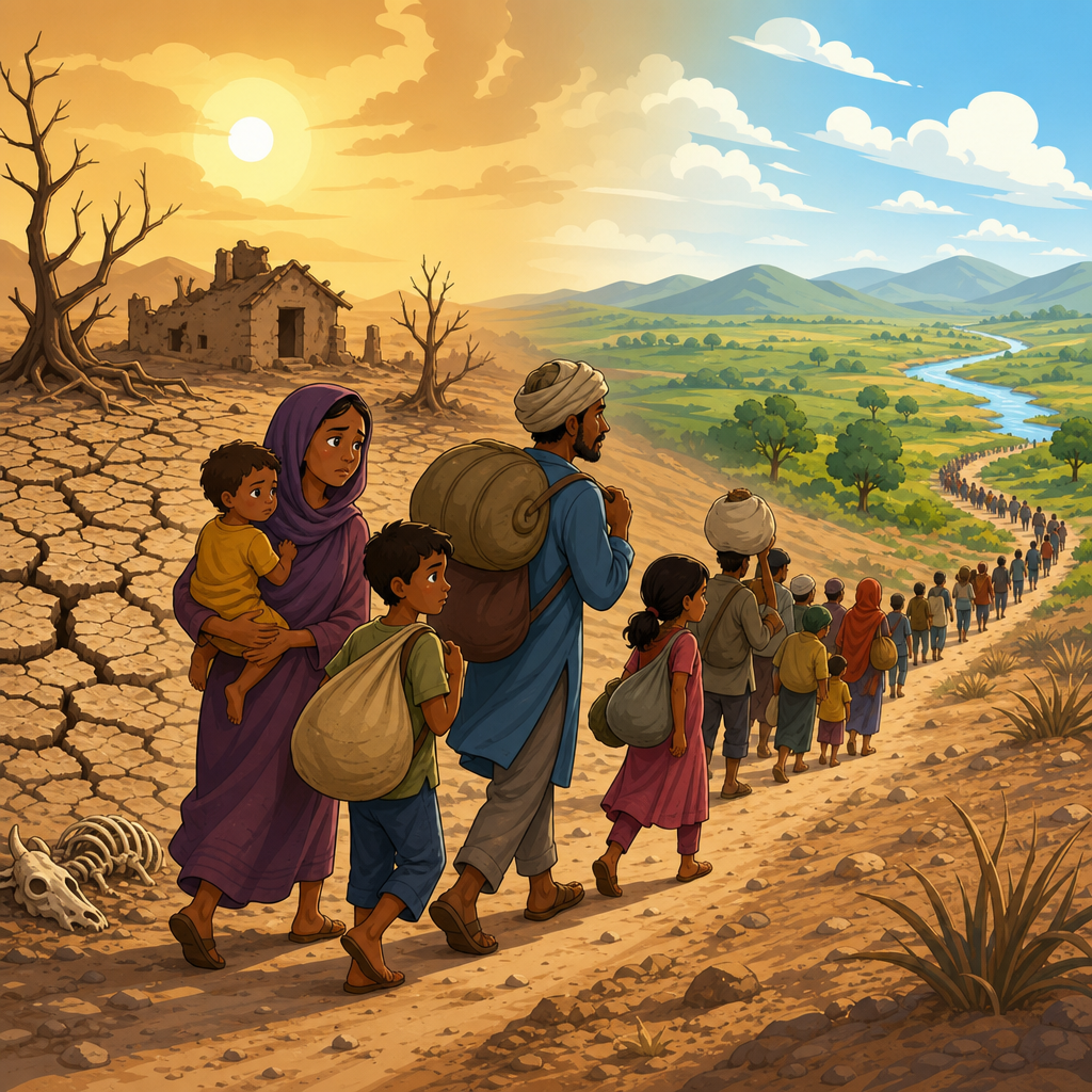
A hub on floods and droughts should make one point unmistakably clear: these hazards interact. Drought is not simply “the absence of flooding.” Extended dryness changes soils, vegetation, water demand, and watershed behavior in ways that can worsen later floods. Severely dry soils may initially repel water, especially where surface crusting develops, increasing runoff during the first major storm. Vegetation stressed by drought provides less interception and root uptake. In wildfire-prone regions, drought raises fire risk, and post-fire landscapes are among the most dangerous settings for flash flooding and debris flows. I have worked with watershed assessments where the most destructive runoff did not occur in the wettest year, but after a dry period followed by short, intense storms over burned slopes.
Drought itself has four commonly used dimensions. Meteorological drought refers to below-average precipitation. Agricultural drought describes inadequate soil moisture for crops and pasture. Hydrological drought reflects low streamflow, reservoir storage, or groundwater levels. Socioeconomic drought occurs when water shortage disrupts energy production, public supply, industry, or livelihoods. Tools such as the U.S. Drought Monitor, the Standardized Precipitation Index, the Palmer Drought Severity Index, and snowpack measurements help track these conditions. The practical lesson is that water management must prepare for extremes on both sides. Reservoirs must balance flood-control space with water-supply storage. Cities need drainage capacity for cloudbursts and conservation plans for dry years. Farmers need both drainage and irrigation strategies, often within the same decade.
Where each hazard is most common and who faces the highest risk
Flash floods are especially common in steep mountains, desert washes, small coastal watersheds, and dense urban areas with extensive impervious surfaces. Places such as the U.S. Southwest, Mediterranean mountain catchments, South Asian hill regions, and rapidly urbanizing tropical cities all experience deadly rapid-onset flooding. River floods dominate broad alluvial plains and large basin networks, including the central United States, parts of Europe, China, India, Bangladesh, and many African river systems. Exposure is highest where people, roads, substations, hospitals, and farms occupy low-lying floodplains or where informal settlements cluster along channels with poor drainage.
Risk is not evenly distributed. Children, older adults, people with disabilities, low-income households, migrant workers, and residents without vehicles often face greater barriers to evacuation and recovery. Renters may have little control over building improvements, and many do not carry contents insurance. Rural communities can be isolated when bridges are overtopped. Urban neighborhoods may suffer repeated basement flooding because drainage systems were designed for historical rainfall statistics that no longer hold. Indigenous and farming communities may face overlapping impacts on water supply, crops, fisheries, and cultural sites. Effective hazard planning therefore combines hydrology with social vulnerability analysis, transportation planning, language access, and public health support.
Preparedness, forecasting, and long-term mitigation that work
The most effective flood safety measures differ by hazard type but share a common principle: act before water arrives. For flash floods, the priority is rapid warning dissemination and immediate movement to higher ground. Communities need reliable radar coverage, gauge telemetry, burn-scar monitoring, and clear alert thresholds. Households need route planning, weather radio access, and a strict rule never to drive through flooded roads. For river floods, preparation includes floodplain zoning, elevation of critical equipment, backflow prevention, levee inspection, reservoir rule curves, and early evacuation triggers tied to forecast crests. FEMA flood maps are useful but not sufficient on their own; local topography, drainage modifications, and recent development can change actual risk.
Long-term mitigation must also account for drought. Watershed restoration, wetland protection, floodplain reconnection, permeable surfaces, and green infrastructure can slow runoff, improve water quality, and support groundwater recharge. Managed aquifer recharge, water reuse, leak reduction, and drought-tolerant cropping can improve resilience during dry periods without sacrificing flood protection. Nature-based solutions are not a cure-all; they work best when combined with engineered systems such as detention basins, culvert upgrades, spillway design, and redundant power for pumps. The key is integrated water management. If you live, work, or plan in a hazard-prone area, start with your local floodplain map, river gauge, drought monitor, and emergency alerts, then build a plan that treats flash floods, river floods, and drought as connected risks rather than separate problems.
Flash floods and river floods differ most in speed, scale, and warning time, but both can be deadly, expensive, and deeply disruptive. Flash floods strike fast, channel enormous force through small watersheds, and leave little room for hesitation. River floods rise more slowly, yet they spread across larger areas and often cause longer-lasting damage to homes, roads, utilities, farms, and public health systems. Drought completes the picture by showing that water risk is not only about excess; prolonged shortage changes soils, landscapes, infrastructure operations, and community vulnerability in ways that can intensify later flooding. That is why the floods-and-droughts topic should be approached as one connected system, not a set of isolated events.
The practical takeaway is simple. Learn which flood type threatens your area, understand how drought affects local conditions, and prepare according to the actual behavior of water in your watershed. Check official alerts, know your evacuation routes, avoid flooded roads, review insurance coverage, and support land-use and water-management decisions that reduce exposure over time. If you are building your knowledge of environmental disasters, use this hub as your starting point and continue into detailed guides on flash flood safety, river flood forecasting, floodplain management, drought monitoring, and water resilience planning.
Frequently Asked Questions
What is the main difference between a flash flood and a river flood?
The biggest difference is speed. A flash flood develops very quickly, often within minutes to a few hours after intense rainfall, a dam or levee failure, or a sudden release of water. It is typically localized, fast-moving, and extremely dangerous because people may have little to no time to react. Flash floods often occur in urban areas with lots of pavement, in steep terrain, in narrow valleys, or in places where the ground cannot absorb water fast enough.
A river flood, by contrast, usually builds more slowly as water levels rise in a river, stream, or connected floodplain over hours, days, or even longer. River floods are often tied to prolonged rainfall, snowmelt, saturated soils across a large watershed, or a combination of these factors. Because they affect broader drainage systems, river floods can spread across large areas and last much longer than flash floods. In simple terms, flash floods are about sudden onset and rapid flow, while river floods are about rising channels and overflowing water systems over a wider region.
Why are flash floods often considered more immediately dangerous than river floods?
Flash floods are often more immediately life-threatening because they strike fast and with tremendous force. Water moving at high speed can knock adults off their feet, sweep away vehicles, erode roads, destroy bridges, and trap people in low-lying areas before they fully understand what is happening. The danger is not just the water depth but the velocity, debris, and surprise factor. A normally dry creek, drainage ditch, canyon, or city street can turn into a violent flow in a very short time.
River floods can also be deadly and destructive, but they more often provide some lead time for watches, warnings, evacuations, and protective measures such as moving equipment, sandbagging, or closing roads. Flash floods compress that decision window. Emergency managers frequently stress that the greatest risk comes when people underestimate moving water, especially when driving. That is why public safety messaging around flash flooding is so direct: if you encounter floodwater, do not walk or drive through it. Even when river floods are slower to develop, they still carry serious long-term hazards, including contamination, structural damage, mold, displacement, and agricultural losses.
What causes flash floods and river floods, and can the same storm create both?
Yes, the same weather system can create both types of flooding, especially across a large watershed. Flash floods are commonly triggered by intense short-duration rainfall that overwhelms the land’s ability to absorb or drain water. They can also result from thunderstorms repeatedly moving over the same area, burn scars after wildfires, ice jams, sudden snowmelt, or failures of dams and water-control structures. Urban development increases flash flood risk because hard surfaces such as roads, roofs, and parking lots send water into drains and channels quickly instead of allowing it to soak into the ground.
River floods are usually driven by broader hydrologic conditions. These include days of steady rain, seasonal snowmelt, already saturated soils, upstream runoff feeding major rivers, and large-scale storm systems affecting entire basins. In many cases, heavy rain first causes flash flooding in creeks, streets, and tributaries, then that runoff moves downstream and contributes to river flooding later. This is one reason floods and droughts are best understood as part of the wider water cycle. A region can swing from dry conditions that harden soils and reduce infiltration to heavy rain that runs off rapidly, increasing flood risk instead of relieving water stress evenly.
How do warnings, forecasts, and preparedness differ for flash floods compared with river floods?
Preparedness differs because the timeline differs. For flash floods, the focus is on rapid warning, situational awareness, and immediate action. Forecasting tools such as radar, short-term rainfall estimates, stream gauges, and terrain analysis help meteorologists identify danger zones, but the lead time may still be limited. People in flood-prone areas should know whether they live near a creek, wash, drainage channel, underpass, or steep slope; sign up for emergency alerts; and have a simple plan for getting to higher ground quickly. In flash flood situations, waiting for visible water can be a mistake, because conditions may deteriorate faster than expected.
For river floods, forecasting often benefits from watershed-scale monitoring and longer-range hydrologic models. Agencies can track upstream rainfall, snowpack, river stages, soil moisture, and reservoir conditions to estimate how high water may rise and when cresting may occur. That longer lead time can help households, farmers, businesses, insurers, and local governments prepare more deliberately. They may relocate livestock, protect machinery, close vulnerable roads, issue evacuation orders, or stage response resources. In both cases, good preparedness depends on understanding local risk, but for flash floods the key is speed, while for river floods the key is sustained planning and response over a larger area and often a longer duration.
Why does understanding the difference between flash floods and river floods matter for households, planners, farmers, insurers, and emergency managers?
The distinction matters because different flood types create different patterns of risk, damage, and response. Households need to know whether their primary danger is a sudden rush of water with almost no warning or a slower-rising flood that may affect access, utilities, and property over several days. That affects evacuation decisions, insurance choices, home improvements, and where families store valuables or place critical equipment. A home near a small drainage way may face a very different threat profile than one near a major river floodplain.
For planners and engineers, the difference shapes infrastructure design. Flash flood risk may call for better stormwater systems, culvert capacity, land-use restrictions in steep or highly paved areas, and careful management of runoff from new development. River flood management may require floodplain mapping, levee maintenance, detention areas, upstream basin management, and policies that limit construction in areas that regularly inundate. Farmers need to understand both hazards because flash floods can scour fields, wash out soil, and damage local drainage, while river floods can inundate broad agricultural areas, delay planting, contaminate land, and create long recovery timelines. Insurers rely on flood type, exposure, and recurrence patterns to assess claims risk and pricing. Emergency managers use these distinctions to tailor warnings, evacuation zones, rescue operations, road closures, and recovery strategies. In short, understanding the difference is not just about vocabulary; it is essential for making better safety, land-use, economic, and resilience decisions.