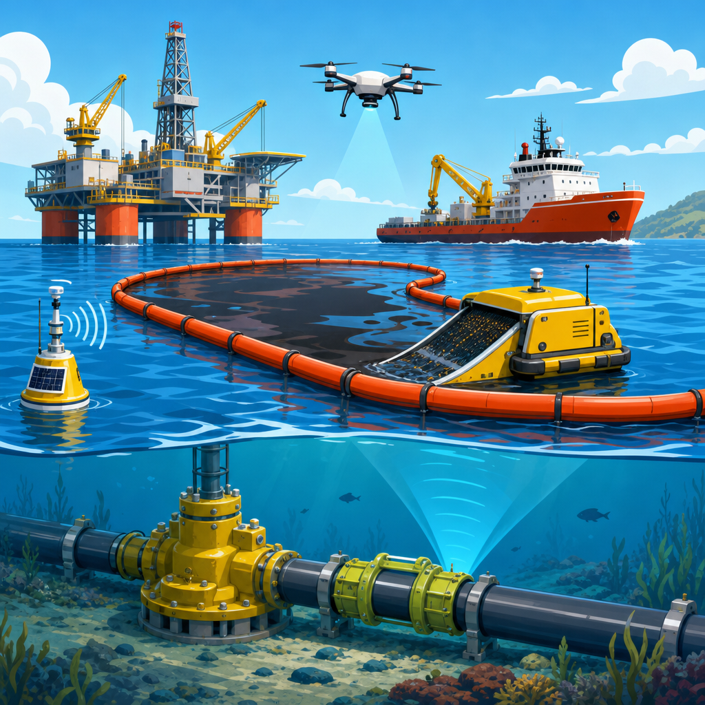
Early warning systems for environmental disasters are the backbone of modern disaster preparedness because they turn scientific detection into time, and time is the single resource that saves the most lives. In practice, an early warning system is not just a siren, an app alert, or a weather bulletin. It is a coordinated chain that starts with monitoring hazards, continues through forecasting and risk analysis, and ends with clear communication and action by authorities, businesses, and households. I have worked on preparedness planning where the technology was strong but evacuation messaging was weak, and the lesson was consistent: a warning system only works when people understand what is happening, believe the source, and know exactly what to do next.
Environmental disasters include floods, hurricanes, wildfires, droughts, heatwaves, landslides, tsunamis, volcanic events, severe storms, and industrial incidents triggered by natural hazards. Disaster preparedness is the organized effort to reduce harm before these events strike through planning, training, infrastructure, communication, and recovery design. This matters because hazard exposure is rising. Urban growth pushes more people into floodplains and fire-prone edges, climate change increases the frequency or intensity of several extremes, and critical infrastructure such as power, transport, water, and telecommunications is tightly interconnected. A single failure can cascade quickly. Strong early warning systems reduce mortality, limit economic losses, improve evacuation efficiency, protect emergency responders, and support faster recovery across entire communities.
At a policy level, effective preparedness aligns with internationally recognized principles such as multi-hazard planning, community-centered communication, redundancy in critical systems, and continuous improvement after drills or real events. The best systems are built long before an emergency. They map risks, define trigger thresholds, train agencies, test communication channels, and connect technical monitoring to practical decisions like school closures, dam releases, hospital surge plans, or route reversals. As a hub for disaster preparedness, this article explains how early warning systems work, what components matter most, which tools and standards are widely used, and how organizations can build stronger readiness across different environmental disasters.
The core components of an effective early warning system
An effective early warning system has four essential parts: risk knowledge, monitoring and forecasting, warning dissemination, and response capability. Risk knowledge means understanding who and what is exposed, where the hazards are, and what vulnerabilities increase damage. In flood planning, for example, this includes topography, river gauge history, drainage bottlenecks, building elevation, social vulnerability data, and evacuation constraints such as bridge choke points. Monitoring and forecasting rely on sensors, satellites, Doppler radar, seismic networks, ocean buoys, air quality monitors, hydrological models, and weather models. Dissemination means getting the message out through multiple channels including cell broadcast, sirens, television, radio, NOAA Weather Radio, social media, and direct outreach to institutions. Response capability is the least visible but most important element because people need transport, shelter, medical support, and authority to act.
Weakness in any one component can break the chain. I have seen jurisdictions with excellent meteorological forecasts still struggle because local alert templates were vague and municipal departments were unclear on who could issue evacuation orders. Conversely, a small coastal town with modest technical capacity can perform well if it has clear thresholds, trusted leaders, and practiced community protocols. The standard many emergency managers now work toward is a people-centered system: warnings must be timely, accurate, understandable, accessible, and actionable. That means using plain language instead of jargon, publishing maps instead of abstract probabilities alone, and repeating specific instructions such as when to leave, where to go, and what routes are closed.
Redundancy is also nonnegotiable. Power failures, cellular congestion, cyber incidents, and language barriers can all stop a message from reaching the public. Preparedness plans should assume at least one channel will fail. That is why mature systems combine digital alerts with outdoor sirens, local media partnerships, backup radio communications, satellite phones for field teams, and door-to-door notification plans for high-risk zones. For more detailed planning, related subtopics typically include evacuation planning, emergency communication strategies, business continuity, resilient infrastructure, and community risk mapping.
How preparedness differs by hazard type
Different environmental disasters demand different warning windows, decision thresholds, and protective actions. Hurricanes often provide days of lead time, which allows staged evacuations, hospital transfers, fuel positioning, and public works deployment. Floods vary widely: riverine floods may permit long lead times, while flash floods can develop in minutes, especially in steep terrain or dense urban areas with poor drainage. Wildfires can spread unpredictably with wind shifts, making evacuation zones highly dynamic. Heatwaves are slower-onset disasters but can be deadlier than dramatic storms because impacts accumulate among elderly residents, outdoor workers, and people without cooling access. Tsunamis offer very short warning windows near the source but more time for distant coasts with basin-scale monitoring.
Preparedness therefore has to match the hazard. For tropical cyclones, forecast cones, storm surge modeling, and contraflow traffic plans are central. For wildfire, fuel conditions, remote sensing, ignition detection, defensible space, and public safety power shutoff planning may matter more. For drought, warnings focus less on immediate evacuation and more on water restrictions, agricultural planning, wildfire escalation, and public health. Landslide preparedness depends on slope monitoring, rainfall thresholds, geotechnical surveys, and building setbacks. A community that copies one generic warning process across every hazard usually underperforms because each event unfolds differently and requires different decisions.
| Hazard | Typical warning lead time | Key monitoring tools | Priority preparedness actions |
|---|---|---|---|
| Hurricane | 2 to 5 days | Satellites, radar, ensemble weather models, storm surge models | Evacuation staging, shelter activation, hospital transfer, fuel and supply positioning |
| Flash flood | Minutes to hours | Rain gauges, radar rainfall estimates, stream gauges, hydrologic models | Rapid alerts, road closures, swift-water rescue readiness, movement to higher ground |
| Wildfire | Hours to days | Satellite hotspots, cameras, weather stations, fuel moisture data | Evacuation zones, defensible space, route management, smoke advisories |
| Heatwave | 3 to 7 days | Temperature forecasts, humidity indices, health surveillance | Cooling centers, worker protection, welfare checks, grid contingency planning |
| Tsunami | Minutes to hours | Seismic networks, deep-ocean buoys, tide gauges | Immediate vertical or inland evacuation, port closure, coastal route control |
The practical takeaway is simple: the shorter the warning window, the more preparedness must be pre-decided. Communities facing tsunamis, flash floods, or fast-moving fires need trigger-based action plans that do not depend on lengthy deliberation. Communities facing slower hazards need strong coordination for logistics, public health, and infrastructure continuity over longer periods.
The technology stack behind modern alerts
Modern early warning systems combine observation networks, models, communication platforms, and operational dashboards. National meteorological and hydrological services typically provide foundational forecasts using numerical weather prediction, radar, satellite imagery, and data assimilation. Agencies then localize the information through geographic information systems, flood inundation mapping, wildfire spread models, or impact-based forecasting. Common tools include Doppler radar for storm structure, LiDAR terrain data for flood mapping, remote automatic weather stations, SCADA data from dams and utilities, and satellite products from programs such as Copernicus and NASA Earth observation missions.
On the alerting side, governments increasingly use cell broadcast and wireless emergency alerts because they can reach many devices quickly without requiring user opt-in to a specific app. Mass notification platforms, integrated public alert and warning systems, GIS dashboards, and common alerting protocol feeds help synchronize messaging across channels. CAP is especially important because it provides a standardized format for warning messages, allowing consistent distribution to media, apps, websites, and public signage. In operational centers, I have found that a clean dashboard showing threshold exceedance, forecast confidence, exposed population, and recommended actions is more useful than a dense scientific interface. Decision-makers rarely need every variable; they need the variables that change action.
Technology still has limits. Forecast uncertainty is unavoidable, sensor maintenance is expensive, and false alarms can erode trust if not explained properly. Rural areas may lack coverage, and low-income communities may rely on fewer digital channels. This is why mature programs pair advanced analytics with ground truth from local responders, utility crews, community organizations, and public health teams. The strongest warning systems are not purely technical products. They are operational systems that translate scientific uncertainty into practical choices with clear accountability.
Communication, trust, and public response
The public does not respond to warnings based on technical accuracy alone. People act when messages are specific, repeated, consistent, and delivered by trusted sources. Effective warning communication answers five questions immediately: what is happening, where it is happening, when it will affect me, what I should do, and where I can get updates. For example, “Flash flood warning for neighborhoods along Creek Road until 6:00 p.m. Move to higher ground now. Do not drive through water. Shelter available at Central High School.” That phrasing performs better than a generic hazard statement because it connects the threat to action.
Trust is built before a disaster. Communities that regularly run drills, publish hazard maps, and communicate transparently about uncertainty tend to see better compliance. During wildfire seasons, some counties now use zone-based evacuation maps with labels residents can memorize in advance. During heat emergencies, cities partner with health departments, transit agencies, libraries, and nonprofits so cooling center information reaches people who may not follow weather channels. Multilingual communication is essential. So is accessibility for people with hearing, vision, mobility, or cognitive needs. Preparedness fails if the warning only reaches the most connected and mobile residents.
False alarms and missed alarms both damage credibility, but silence is worse. The correct approach is calibrated transparency. If confidence is moderate, say so and explain why protective action is still warranted. I have seen this work well when emergency managers pair technical forecasts with scenario language such as “best case,” “most likely,” and “reasonable worst case.” That framework helps businesses, schools, and families prepare proportionately instead of waiting for perfect certainty, which never arrives in real incidents.
Building a preparedness program that works in the real world
Disaster preparedness is not a single plan on a shelf. It is a program with governance, funding, training, maintenance, and review cycles. Start with a hazard and vulnerability assessment. Identify priority threats, exposed populations, critical assets, and interdependencies. Then define operational thresholds. For example, a river stage may trigger sandbag deployment, a higher threshold may trigger neighborhood evacuation, and a higher one may initiate wastewater plant shutdown procedures. Predefining these actions reduces hesitation under pressure and improves coordination across departments.
Exercises are where plans become usable. Tabletop drills test decision flow, while full-scale exercises expose communication failures, traffic bottlenecks, shelter intake issues, and resource gaps. After-action reviews should lead to specific corrective actions with owners and deadlines, not generic lessons-learned documents. Business continuity planning also belongs inside preparedness because private employers control large parts of transport, supply chains, food distribution, telecommunications, and payroll continuity. Schools, hospitals, ports, and utilities need annexes tailored to their operational realities.
Preparedness also depends on land use and infrastructure choices. Flood warning systems are stronger when paired with updated floodplain maps, detention capacity, pump redundancy, backflow prevention, and protected substations. Wildfire warnings are more credible when communities invest in fuel reduction, ignition-resistant construction, and evacuation route maintenance. Heat preparedness improves when cities add tree canopy, cool roofs, backup power for cooling sites, and worker safety policies. In other words, warnings are most effective when they sit inside broader resilience planning. If your organization is building out this subtopic, related deep-dive articles should cover emergency kits, evacuation checklists, continuity of operations, hazard-specific family plans, insurance readiness, and post-disaster damage assessment.
What success looks like and how to improve over time
A successful early warning system produces measurable outcomes: faster alerts, higher message reach, better evacuation clearance times, fewer preventable deaths, lower responder exposure, and reduced disruption to essential services. Performance should be tracked using practical metrics such as sensor uptime, forecast lead time, alert issuance time, multilingual coverage, shelter activation speed, and percentage of households in high-risk zones enrolled in notifications where opt-in systems are used. For public agencies, annual reviews should compare incidents and exercises against these indicators and tie improvements to budget decisions.
No system eliminates risk, and not every disaster can be forecast with the same precision. Still, communities consistently perform better when they invest in risk knowledge, reliable monitoring, clear communication, and rehearsed action. Early warning systems for environmental disasters matter because they convert science into decisions and decisions into survival. If you are building a disaster preparedness strategy, start with your highest-risk hazards, map your warning chain from detection to public action, test it under realistic conditions, and strengthen the weak links before the next emergency arrives.
Frequently Asked Questions
What is an early warning system for environmental disasters?
An early warning system for environmental disasters is a connected process designed to detect danger early, assess what it means, and communicate clear instructions before a hazard becomes a catastrophe. It is much more than a single tool such as a siren, text alert, weather bulletin, or emergency app. A complete system usually includes four core parts: monitoring hazards, forecasting how those hazards may develop, analyzing who and what is at risk, and sending understandable warnings that lead to practical action.
For example, in the case of floods, sensors may track rainfall, river levels, and soil saturation. Meteorologists and hydrologists then model where floodwaters are likely to go and how severe the impact could be. Emergency managers translate that scientific information into messages that tell residents whether to prepare, evacuate, move vehicles, protect utilities, or avoid certain roads. The warning only works if the people receiving it understand it, trust it, and know what to do next.
That is why experts often describe early warning systems as the backbone of disaster preparedness. Their value is not just in predicting events, but in buying time. Even a few extra minutes can help a family get to higher ground, allow a hospital to activate emergency procedures, or give local authorities enough notice to close vulnerable infrastructure. In short, early warning systems turn scientific detection into action, and action is what reduces loss of life, injury, and damage.
Why are early warning systems so important in disaster preparedness?
Early warning systems are important because time is the most valuable resource during an environmental emergency. The earlier a community understands that a threat is developing, the more options it has to respond safely and effectively. Without warning, people may be forced to make life-or-death decisions in minutes or seconds. With warning, they can evacuate, protect property, move critical equipment, secure animals, relocate supplies, and follow official safety procedures in an organized way.
These systems also reduce pressure on emergency services. When warnings are timely and specific, communities can take early protective steps before conditions become chaotic. That can mean fewer road rescues during floods, fewer injuries during storms, and a lower burden on hospitals, fire departments, and search-and-rescue teams. Businesses can shut down operations safely, schools can move students to secure locations, and local governments can pre-position response resources where they are most needed.
Just as importantly, strong early warning systems support long-term resilience. They help governments and organizations identify recurring patterns of risk, improve infrastructure planning, and build public awareness over time. Communities that receive regular, reliable alerts often become better prepared because they learn what warning levels mean and how to respond. In that sense, early warning systems do not only save lives during one event; they strengthen readiness across many future events as well.
How do early warning systems work from detection to public action?
Early warning systems work as a chain of connected steps, and each link in that chain matters. The first step is monitoring. This can involve weather satellites, seismic instruments, river gauges, ocean buoys, wildfire detection cameras, radar systems, air quality sensors, and many other tools depending on the hazard. These technologies continuously collect data on changing environmental conditions and help experts identify signs that a dangerous event may be developing.
The second step is forecasting and risk analysis. Scientists and technical agencies interpret incoming data to estimate what may happen, when it may happen, and which areas are most likely to be affected. This stage often uses computer models, historical patterns, and local vulnerability information. A storm forecast, for example, becomes much more useful when it is paired with data about low-lying neighborhoods, infrastructure weaknesses, population density, and evacuation routes.
The third step is communication, which is where technical knowledge must be translated into plain, actionable guidance. Warnings need to be clear, timely, consistent, and accessible. That usually means using multiple channels such as mobile alerts, radio, television, social media, sirens, community leaders, and official websites. Messages should explain the threat, expected timing, affected locations, severity level, and exact actions people should take. The final step is response. Authorities, businesses, and households must know how to act once the warning is issued. If people do not trust the message, do not understand it, or do not have a realistic way to respond, the system is incomplete no matter how advanced the monitoring technology may be.
What types of environmental disasters can early warning systems help address?
Early warning systems can support preparedness for a wide range of environmental disasters, although the speed and nature of the warning vary by hazard. Some hazards, such as hurricanes, floods, heatwaves, droughts, severe storms, wildfire spread, volcanic unrest, and harmful air quality events, may allow hours, days, or even weeks of advance notice. In these cases, early warning systems can support evacuation planning, resource deployment, infrastructure protection, and public health measures.
Other hazards develop much faster. Tsunamis, flash floods, landslides, and earthquakes may provide very limited warning time, but even seconds to minutes can still make a major difference. Automated systems can stop trains, shut down gas lines, open emergency communications channels, and trigger immediate protective actions. For coastal communities, a tsunami alert issued quickly after an offshore earthquake can save many lives if evacuation routes are known and people understand the urgency.
These systems are also increasingly important for slower-moving but highly dangerous threats linked to climate and environmental change. Extended heatwaves can trigger health alerts for vulnerable populations, drought warnings can guide water management and agricultural decisions, and wildfire smoke alerts can help schools, employers, and families reduce exposure. In every case, the goal is the same: identify risk early enough to reduce harm. The exact tools and timelines differ, but the principle of turning information into protective action remains constant.
What makes an early warning system effective for communities, businesses, and households?
An effective early warning system is accurate, timely, trusted, and usable. Accuracy matters because false alarms can weaken public confidence, while missed events can be devastating. Timeliness matters because a warning that arrives too late is no warning at all. Trust matters because people are more likely to act when they believe the source is credible and the advice is consistent. Usability matters because warnings must be easy to understand and linked to realistic steps that different audiences can actually take.
For communities, effectiveness often depends on strong coordination between scientific agencies, emergency managers, local governments, schools, health systems, transportation authorities, and media outlets. For businesses, it means integrating alerts into continuity plans so staff know when to shut down operations, protect equipment, move inventory, or switch to remote procedures. For households, it means understanding local risks in advance, knowing evacuation routes, preparing emergency kits, and recognizing the difference between a watch, an advisory, and a mandatory warning or evacuation order.
Accessibility is another critical factor. Warnings should reach people in multiple languages and formats, including options for those with hearing, vision, mobility, or digital access challenges. Redundancy is equally important, because no single alert channel is reliable in every emergency. A strong system combines science, communication, preparedness, and public education. The most effective early warning systems are not the ones with the most technology alone; they are the ones that successfully move people from awareness to action when it matters most.