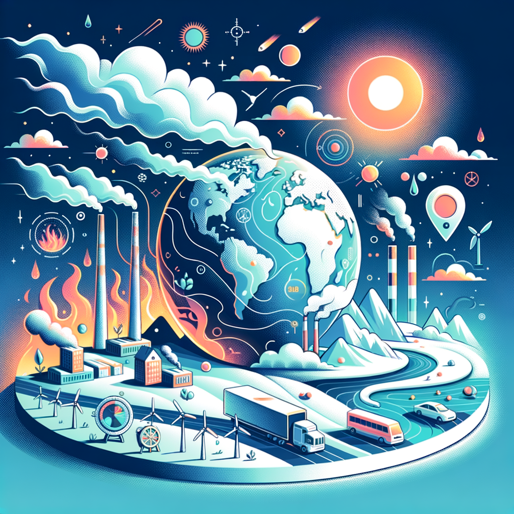
Island nations are on the front line of climate change, and nowhere is the crisis more visible than in the threat of rising seas. For low-lying countries built on coral atolls, narrow coastal plains, and small volcanic islands, sea level rise is not an abstract forecast for 2100. It is already disrupting homes, roads, freshwater supplies, food systems, schools, ports, and national budgets. When people search for climate change by country, island states offer the clearest view of how global warming translates into local damage, political pressure, and hard choices about adaptation, relocation, and survival.
Rising seas are driven mainly by two linked processes: thermal expansion, which occurs as warmer ocean water takes up more space, and land ice melt from glaciers and the Greenland and Antarctic ice sheets. According to the Intergovernmental Panel on Climate Change, global mean sea level has risen by roughly 20 centimeters since 1901, with the rate accelerating in recent decades. That global average matters, but island nations experience climate risk through local conditions such as tides, storms, reef health, land subsidence, shoreline shape, and the location of roads, clinics, airports, and wells. A country can face severe impacts even if the average annual rise sounds modest on paper.
In my work reviewing coastal risk plans and country adaptation strategies, the most important lesson has been this: sea level rise is rarely a single hazard. It compounds king tides, cyclone surge, beach erosion, saltwater intrusion, coral bleaching, and infrastructure fragility. The result is a multiplier effect. A road that floods six times a year instead of once becomes expensive to maintain. A freshwater lens contaminated by seawater pushes communities toward imported bottled water or desalination. A damaged reef no longer absorbs wave energy as effectively, increasing erosion along already stressed shorelines.
This hub article examines climate change by country through the lens of island nations, from Pacific atoll states to Indian Ocean archipelagos and Caribbean islands. It defines the main risks, explains how impacts differ between countries, and outlines the adaptation measures governments are using now. It also serves as a foundation for deeper country-specific coverage, because the climate reality in Maldives is not identical to Kiribati, and the challenges facing Fiji differ from those in the Bahamas. Understanding those differences is essential for policymakers, investors, educators, and readers trying to follow the global climate story with precision rather than generalization.
Why Island Nations Face Disproportionate Climate Risk
Island nations face disproportionate climate risk because exposure, sensitivity, and limited adaptive capacity often overlap in the same places. Many of these countries concentrate population and infrastructure close to the coast. Airports are typically built on flat land near sea level. Ports, tourism districts, fisheries facilities, power plants, hospitals, schools, and government offices also cluster in narrow coastal strips. When sea levels rise or storm surge worsens, the systems that support everyday life are hit simultaneously rather than one by one.
Low elevation is a defining factor, especially for atoll nations such as Tuvalu, Kiribati, and the Marshall Islands, where much of the land sits only one to three meters above present sea level. In these settings, even small increases in baseline sea level can turn high-tide flooding into a chronic problem. Saltwater intrusion is especially serious because freshwater often exists as a shallow groundwater lens floating above seawater. Once that lens is contaminated, recovery can be slow, and rainfall variability linked to climate change can make it worse.
Economic structure adds another layer of vulnerability. Tourism-dependent countries like the Maldives, Seychelles, Antigua and Barbuda, and many Caribbean states rely on beaches, reefs, and coastal amenities for revenue, jobs, and tax receipts. Fisheries-dependent islands depend on marine ecosystems that are being altered by ocean warming and acidification. Import dependence raises costs when extreme weather disrupts ports. Small domestic markets and high debt levels leave less fiscal room for major coastal defenses, managed retreat, or resilient public housing programs.
Isolation also matters. After extreme events, rebuilding materials, heavy equipment, and specialized engineering expertise often need to be imported. That increases costs and slows response times. In larger continental countries, governments can often reroute logistics inland; many islands do not have that option. A single damaged port or airport can interrupt emergency response, tourism arrivals, food imports, and medical supply chains at the same time.
How Sea Level Rise Affects Countries Differently
Sea level rise does not produce one uniform outcome across all island nations. Geography, geology, governance, and income shape the experience. Volcanic islands such as Dominica, Saint Lucia, and parts of Fiji have higher ground that can reduce direct inundation risk for some communities, but they still face coastal erosion, flood damage to ports and roads, and landslide risks as rainfall intensifies. By contrast, coral atolls have little elevation to retreat toward, making the same amount of sea level rise much more existential.
Population distribution is another major variable. In countries where the capital city dominates the economy, concentrated risk can threaten national stability. South Tarawa in Kiribati and Male in the Maldives are examples of dense urban coastal settlements where housing pressure, waste management, drainage limits, and shoreline exposure intersect. A flood in such places is not just a local disaster; it can disrupt governance, commerce, public health, and education nationwide.
The condition of natural buffers changes the picture as well. Healthy coral reefs, mangroves, and seagrass beds reduce wave energy, trap sediment, and stabilize shorelines. Where reefs have bleached repeatedly or mangroves have been cleared for development, coasts become more exposed. This is why two islands with similar elevation can show different erosion rates and flood damage over time.
Countries also differ in administrative capacity. Some have advanced coastal zoning, hazard mapping, and climate finance teams able to prepare bankable projects for the Green Climate Fund or multilateral development banks. Others struggle with data gaps, overlapping land tenure claims, or limited engineering staff. The climate challenge is physical, but national outcomes often depend on institutions as much as geography.
Country Snapshots Across the Pacific, Indian Ocean, and Caribbean
Tuvalu is often cited because of its extremely low elevation and narrow land area. On Funafuti, tidal flooding and erosion already affect roads, homes, and public spaces, and the government has pursued land reclamation and long-term resilience planning. Kiribati faces similar pressures, especially in South Tarawa, where overcrowding intensifies sanitation, freshwater, and housing risks. The Marshall Islands has dealt with destructive king tide flooding, and its adaptation strategy includes elevating infrastructure and strengthening community resilience.
In the Indian Ocean, the Maldives is a defining case. About 80 percent of its land area lies less than one meter above sea level. The country has invested heavily in engineered defenses, including the sea wall around Male and the development of Hulhumale, an elevated reclaimed island designed to reduce exposure and accommodate population growth. Seychelles and Mauritius face different profiles because higher terrain offers some relocation potential, yet coastal tourism assets, fisheries, and infrastructure remain highly exposed.
In the Caribbean, the Bahamas illustrates how sea level rise interacts with hurricanes. Much of the archipelago is low lying, and Hurricane Dorian in 2019 showed how catastrophic storm surge can be when baseline risks are already high. Antigua and Barbuda, Barbados, and Saint Kitts and Nevis all face erosion, freshwater stress, and tourism exposure. Dominica’s steep topography reduces permanent inundation risk in some areas but does not shield it from coastal damage, stronger rainfall extremes, or infrastructure disruption.
These examples show why climate change by country must be analyzed with local detail. Island nations share common threats, but no serious policy discussion should treat them as interchangeable. Exposure patterns, settlement history, reef condition, financing access, and state capacity create distinct risk profiles that require country-specific responses.
What Governments Are Doing Now
Most island governments are not waiting for perfect data or a single global solution. They are combining hard infrastructure, ecosystem restoration, land-use policy, and social planning. Seawalls, revetments, groynes, raised roads, improved drainage, and floodgates are common first responses in urban areas where critical infrastructure cannot easily move. These measures can protect high-value assets, but they are expensive to maintain and can shift erosion problems to adjacent coastlines if poorly designed.
Nature-based adaptation is increasingly central. Mangrove restoration, coral reef rehabilitation, beach nourishment, and dune stabilization can reduce wave energy and protect shorelines while supporting fisheries and biodiversity. These options usually work best in combination with regulation that limits sand mining, reef damage, and high-risk construction too close to the waterline. They are not a substitute for all engineered defenses, but they often deliver broader benefits at lower long-term ecological cost.
Planned relocation is the most difficult measure, yet in some locations it is becoming unavoidable. Fiji has developed guidance around community relocation after repeated flooding and erosion. In practice, relocation is not simply moving houses. It requires land rights resolution, livelihoods planning, school access, transport links, and cultural continuity. Communities resist relocation when it is imposed from above or when new sites lack economic opportunity. Good policy treats relocation as a social transition, not a construction project.
| Approach | Best Use | Strength | Limitation |
|---|---|---|---|
| Seawalls and revetments | Dense urban coasts, ports, airports | Immediate physical protection | High cost, maintenance burden |
| Mangrove and reef restoration | Rural coasts, fisheries zones, tourism areas | Reduces wave energy and supports ecosystems | Needs time and suitable local conditions |
| Raised infrastructure | Roads, utilities, hospitals, schools | Keeps essential services operating during floods | Can be expensive at national scale |
| Planned relocation | Repeatedly flooded settlements | Reduces long-term exposure | Complex social and legal challenges |
Climate finance remains a constant constraint. Island states have argued, correctly, that countries contributing least to global emissions are paying some of the highest adaptation costs. Accessing finance, however, requires technical studies, procurement systems, safeguards compliance, and long project preparation timelines. Governments that build strong climate ministries, data systems, and partnerships with agencies such as the World Bank, Asian Development Bank, Caribbean Development Bank, and UNDP are generally better positioned to turn vulnerability assessments into funded projects.
The Limits of Adaptation and the Question of Sovereignty
Adaptation can reduce risk substantially, but it has limits. Some shorelines cannot be defended indefinitely at reasonable cost. Some freshwater systems will become harder to protect as saltwater intrusion worsens. Repeated rebuilding after storms can trap governments in a cycle of repair rather than resilience. The hard truth is that for the lowest-lying island nations, the long-term risk is not only property loss. It is the potential loss of habitable land, cultural heritage, and aspects of statehood tied to territory.
This raises legal and political questions that were once hypothetical and are now active policy concerns. What happens to maritime zones if land becomes uninhabitable? Can a nation retain sovereign rights over its exclusive economic zone if its population relocates? How should migration pathways be designed so they preserve dignity, citizenship, and community rather than producing displacement under crisis conditions? Pacific leaders have pushed these issues into international forums because they are central to the future of affected states.
There is also a risk of telling the story too narrowly. Island nations are not helpless victims waiting to disappear. Many are diplomatic leaders on climate ambition, ocean governance, and loss-and-damage negotiations. They have developed sophisticated adaptation plans, community knowledge systems, and legal arguments that larger countries increasingly study. The proper framing is not inevitability, but constrained agency under worsening physical conditions created largely by emissions elsewhere.
Why This Hub Matters for Climate Change by Country
As a hub for climate change by country, island nations provide a practical way to compare how one global process creates different national realities. They highlight the core variables every country page should examine: physical exposure, economic dependence on vulnerable sectors, public infrastructure concentration, ecosystem condition, governance capacity, and access to finance. Whether the next article focuses on the Maldives, Fiji, the Bahamas, Cape Verde, or Samoa, those categories help readers move from headline awareness to grounded understanding.
The key takeaway is straightforward. Rising seas threaten island nations through flooding, erosion, freshwater loss, ecosystem decline, and escalating economic costs, but impacts vary sharply by country. The most effective responses combine coastal engineering, ecosystem protection, better land-use planning, resilient infrastructure, and, where necessary, carefully designed relocation. If you are building a deeper view of climate change by country, start with island states, then follow the country-specific links and compare how each nation is adapting to a changing ocean.
Frequently Asked Questions
Why are island nations especially vulnerable to rising sea levels?
Island nations face a unique combination of geographic, economic, and environmental pressures that make sea level rise far more dangerous than it is for many larger countries. A great number of island states are low-lying, with communities, roads, airports, hospitals, schools, ports, and government buildings concentrated along narrow coastal zones. In coral atoll countries, land may sit only a few meters above sea level, which means even modest increases in sea level can translate into frequent flooding, coastal erosion, and saltwater intrusion into freshwater supplies. Unlike continental countries, island states often have limited room to retreat inland, and some have no meaningful “higher ground” at all.
Another reason for their vulnerability is that daily life and national economies are tightly tied to the coast. Fishing, tourism, shipping, and local trade all depend on stable shorelines and functioning coastal infrastructure. When beaches erode, reefs degrade, or harbors flood more often, the economic impact can be immediate. Rising seas also intensify the damage caused by storms, king tides, and heavy rainfall, turning what might once have been occasional hazards into repeated emergencies. For many island nations, the threat is not just environmental; it affects public health, food security, education, transport, housing, and national sovereignty. That is why island states are often described as being on the front line of climate change.
How is sea level rise already affecting everyday life in island nations?
For many island communities, sea level rise is no longer a future scenario discussed only in scientific reports. It is already showing up in everyday disruptions that affect households, public services, and local economies. Roads flood more often during high tides, forcing school closures, delaying transport, and making it harder for emergency services to move quickly. Homes built near the shore may face repeated inundation, foundation damage, and erosion that gradually undermines the land beneath them. In some places, cemeteries, cultural sites, and family lands are being lost to the sea, adding emotional and social strain to the physical damage.
Freshwater is one of the most serious day-to-day concerns. Many island nations rely on shallow groundwater, rainwater collection, or small freshwater lenses that can be contaminated by saltwater intrusion as the sea rises. Once drinking water becomes brackish, families may need to travel farther, buy imported water, or depend on expensive desalination systems. Agriculture is also affected when saltwater damages soils and reduces crop yields, making local food production less reliable. Fisheries can suffer as coral reefs and coastal ecosystems are stressed by warming waters and changing ocean conditions. Together, these impacts raise living costs, strain public budgets, and force governments to spend more on repairs, adaptation, and emergency response rather than long-term development.
Can island nations adapt to rising seas, or will some communities have to relocate?
Adaptation is possible, and many island nations are already investing in it, but the options are often expensive, technically complex, and limited by geography. Governments and local communities are building seawalls, restoring mangroves, elevating roads and buildings, improving drainage systems, strengthening water infrastructure, and updating land-use planning to reduce risk. Nature-based solutions such as protecting coral reefs, coastal vegetation, and wetlands can help buffer wave energy and slow erosion, while engineered defenses can provide more immediate protection in densely populated areas. These measures can buy time, reduce losses, and improve resilience, especially when they are paired with stronger early warning systems and climate-informed infrastructure planning.
At the same time, adaptation has limits. In the most exposed locations, especially on very low coral atolls, repeated flooding and water contamination may eventually make some areas difficult or unsafe to inhabit. In those cases, relocation may become part of the long-term strategy. This can mean moving households within the same island, shifting population to higher islands within the same country, or in more severe cases exploring international migration pathways. Relocation is not just a technical decision about physical safety; it involves land rights, jobs, cultural identity, language, community ties, and political status. For island nations, the goal is usually not simply to move people, but to preserve dignity, social cohesion, and national continuity while reducing risk. That is why many leaders emphasize both aggressive global emissions cuts and major financial support for adaptation.
What role do coral reefs, mangroves, and coastal ecosystems play in protecting island nations?
Coastal ecosystems are a critical first line of defense for many island nations. Coral reefs help break wave energy before it reaches the shore, reducing erosion and the impact of storm surge. Mangroves stabilize coastlines with their root systems, trap sediments, and act as natural buffers during coastal flooding. Seagrass beds and wetlands also support shoreline stability while improving water quality and providing habitat for marine life. When these ecosystems are healthy, they can significantly reduce the physical risks associated with sea level rise and stronger coastal storms.
These natural systems also support food security, livelihoods, and tourism. Reefs sustain fisheries that many island communities depend on for both income and nutrition, while mangroves and coastal habitats serve as nurseries for fish and other marine species. Beaches and reef environments attract tourism, which is a major source of revenue in many island economies. However, these ecosystems are under pressure from warming oceans, coral bleaching, pollution, overfishing, and poorly planned coastal development. As climate change intensifies, protecting and restoring ecosystems becomes even more important. Nature-based solutions are not a complete substitute for infrastructure upgrades or global climate action, but they are one of the most cost-effective and locally beneficial tools available to island nations facing rising seas.
Why do island nations play such an important role in global climate discussions?
Island nations play an outsized role in climate discussions because they show, in the clearest possible terms, what climate change looks like when geography leaves very little margin for error. These countries have contributed only a tiny share of historical greenhouse gas emissions, yet they face some of the earliest and most severe consequences. Their experience highlights a central issue in climate politics: those who did the least to cause the problem are often the ones with the fewest resources to deal with the damage. As a result, island states have become powerful moral and diplomatic voices in international negotiations, pushing for stronger emissions cuts, adaptation finance, and recognition of climate loss and damage.
They also matter because the challenges they face today foreshadow broader risks that other coastal regions will increasingly confront in the coming decades. Flooded infrastructure, saltwater intrusion, displacement pressures, insurance losses, and threats to food and water systems are not limited to islands, but island nations are experiencing them earlier and more intensely. Their policy responses, legal arguments, and adaptation strategies therefore offer lessons for the rest of the world. When island leaders call for urgent action, they are not speaking in abstract terms. They are describing measurable threats to land, livelihoods, culture, and, in some cases, the long-term viability of the state itself. That makes island nations essential voices in shaping a more serious and equitable global response to climate change.