Long-term environmental monitoring projects around the globe provide the evidence base for modern environmental science, showing how ecosystems, climate, oceans, air, water, and biodiversity change across decades rather than seasons. In practice, long-term monitoring means collecting standardized measurements repeatedly over many years, often using the same protocols, instruments, and sampling locations so trends can be separated from short-term noise. These programs matter because most environmental shifts unfold slowly, interact across systems, and can be missed entirely by short studies. I have worked with monitoring datasets where a single decade of records looked stable, yet the full thirty-year series revealed warming, species turnover, and altered nutrient cycles. For a hub page on research and discoveries, this topic is foundational: nearly every major finding in environmental science, from rising atmospheric carbon dioxide to coral bleaching frequency, depends on persistent observation.
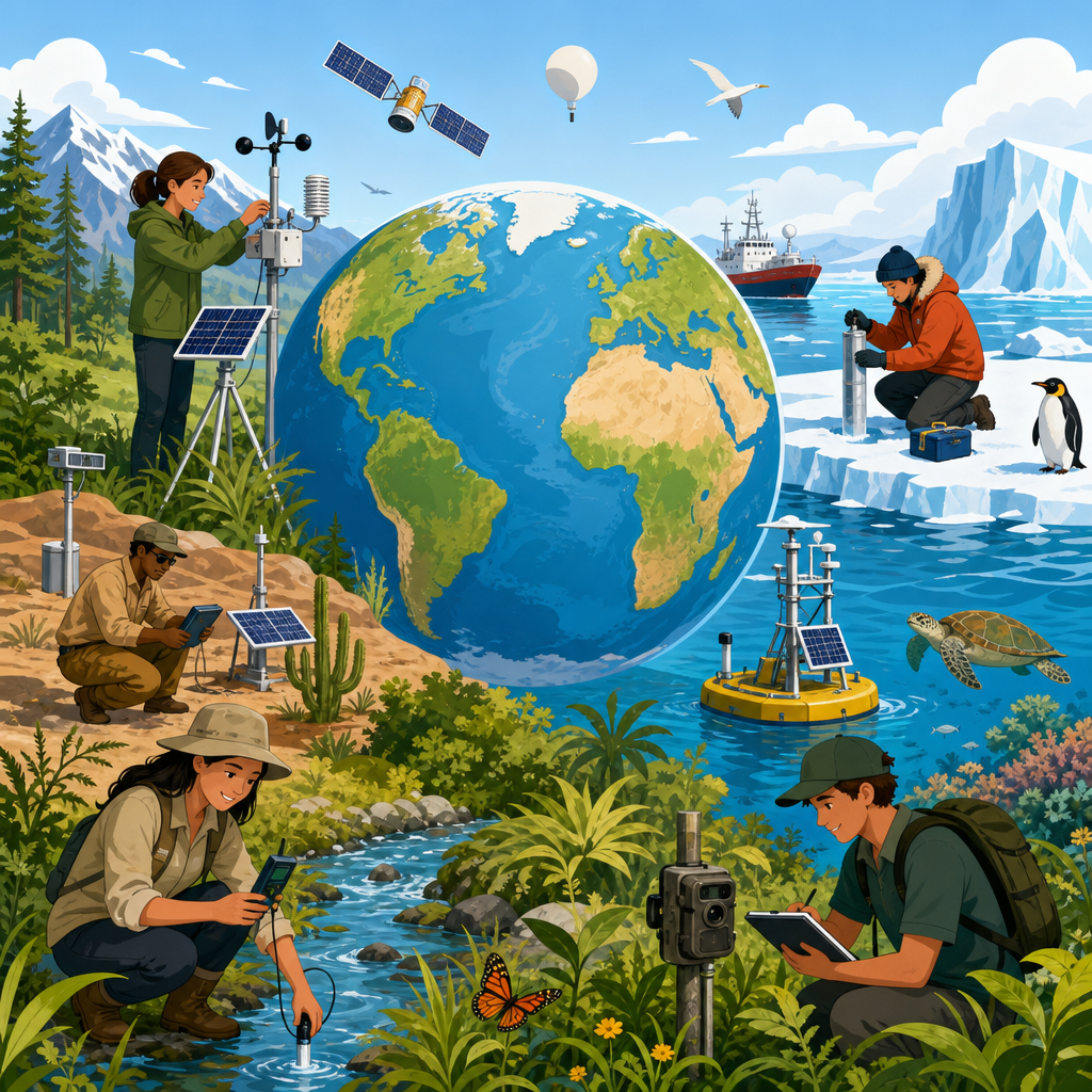
Environmental monitoring spans several linked approaches. Climate monitoring tracks variables such as air temperature, precipitation, greenhouse gases, glacier mass balance, sea level, and ocean heat content. Ecological monitoring follows species abundance, phenology, habitat condition, and food-web dynamics. Hydrological and water-quality monitoring measures streamflow, groundwater levels, dissolved oxygen, nutrients, pH, salinity, turbidity, and contaminants. Atmospheric monitoring includes particulate matter, ozone, nitrogen oxides, sulfur dioxide, and long-range transport of pollutants. Remote sensing extends these records through satellites, aircraft, drones, and sensor networks, while field stations provide the calibrated ground truth needed to trust broad-scale maps. Together, these methods let researchers answer practical questions: Is a river recovering? Are forests storing less carbon? Which coastlines face accelerating flood risk? What species are disappearing before managers notice?
The global importance of long-term environmental monitoring has only increased. Governments use these records to set standards, industries rely on them for compliance and risk management, conservation groups target interventions with them, and communities use them to understand health threats and climate exposure. The strongest projects are built around consistency, open data, quality assurance, and institutional continuity, because useful trends depend on surviving changes in technology, funding, and politics. They also create the connective tissue for related research and discoveries across environmental science: experimental ecology, climate attribution, restoration assessment, public health studies, and predictive modeling all begin with trustworthy baseline records. Understanding the flagship monitoring projects around the world is therefore the best starting point for anyone exploring this research area in depth.
Why Long-Term Monitoring Produces Breakthrough Discoveries
Long-term monitoring produces discoveries because environmental systems are variable by nature. A single drought year can make a wetland seem doomed; one unusually cold winter can make warming appear to pause. Only repeated measurement across many years reveals direction, rate, and magnitude of change. This is why trend detection relies on time series analysis, metadata control, instrument calibration, and consistent sampling design. When these elements are weak, false trends appear. When they are strong, scientists can distinguish real change from seasonal cycles, sensor drift, sampling bias, or weather anomalies.
A classic example is atmospheric carbon dioxide at Mauna Loa Observatory in Hawaii. Since 1958, the Keeling Curve has recorded a steady rise in CO2 alongside a regular seasonal oscillation driven largely by Northern Hemisphere plant growth. That simple, continuous dataset transformed climate science because it showed both natural annual cycles and an unmistakable long-term increase caused by fossil fuel combustion and land-use change. Similar logic applies elsewhere. Continuous stream gauges reveal shifts in flood frequency. Repeated seabird surveys show food-web changes linked to ocean temperature. Forest inventory plots document slower tree growth, altered mortality, and species range movement. Discoveries emerge not from one dramatic measurement, but from disciplined repetition.
Another reason these programs matter is that they create baselines before crises intensify. In my experience, the most valuable datasets are often those collected before anyone predicted the exact problem they would later explain. Historical water chemistry records have clarified acid rain impacts and recovery. Archived biological samples now support contaminant analysis for compounds that were not even regulated when the samples were first stored. Long-term records also allow attribution: if coral cover declines after repeated marine heatwaves and the thermal history is already known, researchers can quantify cause more confidently. Monitoring does not replace experiments, but it tells scientists where, when, and why experiments should focus.
Climate and Atmosphere Networks That Changed Global Science
The most influential climate and atmosphere monitoring projects combine fixed observatories, field campaigns, and global coordination. Beyond Mauna Loa, the Global Atmosphere Watch program of the World Meteorological Organization links stations that measure greenhouse gases, aerosols, ozone, and reactive gases under harmonized protocols. The National Oceanic and Atmospheric Administration operates long-running climate records covering temperature, precipitation, sea level, and atmospheric composition. NASA and the European Space Agency add satellite missions that extend spatial coverage for sea ice, land surface temperature, vegetation productivity, and atmospheric chemistry.
These records underpin some of the clearest discoveries in environmental science. Global mean sea level has risen by more than 20 centimeters since 1900, with satellite altimetry showing acceleration in recent decades. Ocean heat content has increased as the oceans absorb most excess heat trapped by greenhouse gases. Antarctic and Greenland ice mass balance monitoring has revealed increasing ice loss through gravimetry, radar, and field validation. Air quality networks have also documented both progress and persistent inequality: sulfur dioxide and lead concentrations have dropped sharply in many high-income countries after regulation, while fine particulate exposure remains severe in many urban and industrial regions.
For researchers and policy makers, these networks answer direct questions. How fast is warming occurring? Which pollutants are falling, and which are not? Are emissions reductions visible in the atmosphere? Because methods are standardized and openly described, findings from one region can be compared with another. That comparability is essential for this research hub, since climate discoveries connect directly to parallel subtopics such as polar science, wildfire ecology, renewable energy transitions, and environmental health.
Oceans, Coasts, and Coral Reefs Under Continuous Observation
Marine monitoring is difficult and expensive, which makes sustained projects especially valuable. The Argo program, launched in the early 2000s, deploys thousands of autonomous profiling floats that measure temperature and salinity through the upper two kilometers of the ocean, with newer Deep Argo floats sampling greater depths. Argo revolutionized oceanography by making global subsurface conditions observable at a scale impossible through ship surveys alone. Combined with satellite altimetry and sea surface temperature products, Argo data have improved estimates of ocean heat uptake, marine heatwaves, and circulation changes.
Coastal and reef monitoring projects have produced equally important discoveries. The Global Coral Reef Monitoring Network and programs such as the Australian Institute of Marine Science Long-Term Monitoring Program on the Great Barrier Reef show how repeated bleaching events, crown-of-thorns starfish outbreaks, cyclones, and water-quality stress affect coral cover through time. These records demonstrated that marine heatwaves are no longer isolated anomalies; they are recurring disturbances that reduce reef recovery windows. In plain terms, reefs are being hit again before they can fully rebuild.
Long-term tide gauges and shoreline surveys also reveal how sea-level rise interacts with local land subsidence, storm surge, and sediment supply. In delta cities such as Jakarta, Bangkok, and New Orleans, monitoring has shown that relative sea-level rise can be far worse than global averages because the land itself is sinking. That distinction matters for adaptation planning. A global trend may suggest one level of risk, while local monitoring may reveal a much faster practical threat to infrastructure, fisheries, wetlands, and drinking water sources.
Forests, Biodiversity, and Ecological Change on Land
On land, long-term ecological research sites and biodiversity observatories document how ecosystems respond to warming, nitrogen deposition, invasive species, altered fire regimes, and habitat fragmentation. The Long Term Ecological Research Network in the United States, established in 1980, includes deserts, forests, tundra, agricultural systems, lakes, and coastal zones. Researchers at these sites track vegetation, soils, hydrology, decomposition, nutrient cycling, and species interactions using protocols designed for continuity. Similar long-running efforts include the Smithsonian Forest Global Earth Observatory, or ForestGEO, which monitors large forest plots around the world tree by tree.
These projects have generated major discoveries. Forest plots in tropical regions have improved estimates of carbon storage and clarified that drought sensitivity varies by species and soil type. Repeated bird surveys in Europe and North America have shown substantial declines in many farmland and grassland species, linking biodiversity loss to land-use intensification. Phenology networks tracking leaf-out, flowering, insect emergence, and migration have documented spring events occurring earlier in many temperate regions. This matters because mismatches can occur: pollinators may emerge before flowers peak, or migratory birds may arrive after insect abundance has already passed its seasonal maximum.
| Project | Region | Main Variables | Key Discovery |
|---|---|---|---|
| Mauna Loa CO2 Record | Hawaii, global relevance | Atmospheric carbon dioxide | Clear long-term rise in CO2 with seasonal cycle |
| Argo | Global oceans | Temperature, salinity, pressure | Improved measurement of ocean heat uptake |
| LTER Network | United States | Ecology, soils, hydrology, climate | Linked ecosystem change to long-term drivers |
| Great Barrier Reef monitoring | Australia | Coral cover, bleaching, disturbances | Repeated heat stress reduces reef recovery |
| Hubbard Brook | New Hampshire, United States | Stream chemistry, forests, precipitation | Acid rain impacts and recovery documented |
One project that deserves special attention is Hubbard Brook Experimental Forest, where decades of watershed and forest monitoring helped establish the ecological effects of acid rain. Scientists measured precipitation chemistry, stream chemistry, and forest responses long enough to show that sulfate and nitrate deposition altered soils and watersheds. Just as importantly, continued monitoring demonstrated partial recovery after emissions controls. That is the ideal research cycle: identify a problem, link cause and effect, inform policy, and then verify whether interventions worked.
Freshwater, Polar, and Urban Monitoring Frontiers
Freshwater systems respond quickly to land use and climate, so rivers and lakes are central to environmental monitoring. Programs under the Global Lake Ecological Observatory Network, national stream gauge services, and long-running limnology stations measure temperature stratification, algal blooms, nutrient loading, oxygen depletion, and ice cover duration. These datasets have shown that many lakes are warming rapidly, harmful algal blooms are becoming more frequent where nutrient pollution remains high, and oxygen loss threatens fisheries and drinking water treatment. Continuous river monitoring has also exposed flashier flow regimes in urbanized watersheds where paved surfaces speed runoff.
Polar monitoring has become a defining frontier of research and discoveries. The Arctic is warming roughly four times faster than the global average in recent decades, according to multiple assessments using long-term records. Sea ice extent tracked by satellite since 1979 shows a steep decline in late summer ice. Permafrost observatories in Alaska, Canada, Siberia, and Scandinavia document thaw that destabilizes infrastructure and releases greenhouse gases such as carbon dioxide and methane. Glacier monitoring through the World Glacier Monitoring Service shows widespread mass loss, with direct implications for sea level, freshwater supply, and mountain hazards.
Urban monitoring, meanwhile, has expanded environmental science into everyday lived experience. Networks of regulatory air monitors, low-cost sensors, heat mapping campaigns, and stormwater observatories reveal sharp local gradients in exposure. Two neighborhoods in the same city can differ by several degrees during a heatwave or by substantial particulate concentrations near major roads and ports. Long-term urban records help planners target tree cover, traffic policy, building standards, and drainage upgrades where they will deliver the greatest public benefit.
What Makes a Monitoring Project Reliable and Useful
Reliable long-term environmental monitoring depends on design choices that are often invisible to the public. Standard operating procedures must specify exactly how, when, and where measurements are taken. Instruments need calibration schedules and maintenance logs. Data managers must track metadata, version changes, detection limits, and quality flags. Spatial representativeness matters: a pristine mountain station is excellent for background atmosphere trends but poor for neighborhood air pollution. Temporal resolution matters too. Monthly grab samples may miss short pollution spikes that continuous sensors would detect.
The best projects also plan for change without breaking continuity. Sensors improve, satellites are replaced, and staff turnover is inevitable. Strong programs run overlap periods when old and new instruments operate together, allowing correction factors to be calculated. They archive raw data as well as processed outputs. They publish methods transparently and make records accessible through repositories such as GBIF, NASA Earthdata, NOAA data portals, PANGAEA, and national environmental databases. Open access accelerates discovery because ecologists, hydrologists, modelers, and health researchers can reuse the same trusted baseline.
There are limitations. Monitoring is expensive, underfunded in many regions, and unevenly distributed across the Global South, deep ocean, and remote terrestrial systems. Political instability can interrupt records. Community-based monitoring can fill some gaps and often improves local relevance, but it still needs training, protocol clarity, and long-term support. The lesson from decades in this field is straightforward: continuity is a scientific asset. Once a record breaks, rebuilding its historical value is impossible.
Long-term environmental monitoring projects around the globe are the backbone of environmental science because they turn scattered observations into evidence strong enough to guide research, policy, and public action. They have revealed rising greenhouse gases, accelerating sea-level rise, ocean heat accumulation, coral reef decline, biodiversity loss, acid rain recovery, freshwater warming, permafrost thaw, and unequal urban pollution burdens. Just as important, they show where interventions work and where risks are intensifying faster than expected.
As a hub for research and discoveries, this topic connects every major branch of environmental science. Climate studies depend on atmosphere and cryosphere records. Conservation depends on biodiversity and habitat surveys. Water management depends on continuous hydrological and chemical measurements. Coastal adaptation depends on tide gauges, reef observations, and subsidence monitoring. If you want to understand any environmental headline in context, start by asking what long-term record supports it, how the data were collected, and whether the trend is local, regional, or global.
The practical benefit is clarity. Good monitoring replaces guesswork with trend lines, baselines, and tested explanations. It helps scientists prioritize research, helps decision-makers allocate resources, and helps communities prepare for change using evidence rather than anecdotes. Explore the related articles in this environmental science hub to go deeper into climate records, biodiversity studies, ocean research, freshwater discovery, pollution tracking, and restoration outcomes.
Frequently Asked Questions
What are long-term environmental monitoring projects, and why are they so important?
Long-term environmental monitoring projects are structured programs that collect the same kinds of environmental data repeatedly over many years or decades. The goal is to create reliable records of change in climate, ecosystems, oceans, rivers, air quality, soils, and biodiversity using standardized methods. That consistency is what makes these projects so valuable. When scientists measure the same variables at the same locations with comparable instruments and protocols over time, they can distinguish genuine long-term trends from temporary fluctuations caused by seasons, storms, droughts, fires, or other short-term events.
These projects are important because many environmental changes happen slowly and can easily be missed without sustained observation. A single year of data might show an unusual heat wave, a low river flow, or a temporary drop in a species population, but it cannot reveal whether that event is part of a larger pattern. Long-term monitoring provides the evidence base needed to understand climate change, habitat loss, pollution impacts, ocean warming, acidification, groundwater decline, shifting migration routes, and changes in ecosystem productivity. It turns isolated observations into meaningful trends.
They also support practical decision-making. Policymakers, conservation agencies, farmers, water managers, public health officials, and infrastructure planners all depend on long records to assess risks and choose effective responses. In other words, long-term environmental monitoring is not just a scientific exercise; it is a foundation for environmental management, adaptation planning, and accountability. Without it, societies would be forced to act on guesswork rather than evidence.
What kinds of data do long-term environmental monitoring programs collect around the world?
Long-term environmental monitoring projects collect a wide range of physical, chemical, and biological data, depending on the systems they are designed to study. Climate-focused programs often track air temperature, precipitation, humidity, wind, solar radiation, and atmospheric greenhouse gas concentrations. Ocean monitoring networks may measure sea surface temperature, salinity, pH, dissolved oxygen, currents, sea level, nutrient levels, and carbon uptake. Freshwater programs typically monitor streamflow, groundwater levels, sediment loads, water temperature, nutrient pollution, contaminants, and aquatic habitat conditions.
Biodiversity and ecosystem monitoring projects add another layer by tracking species abundance, distribution, breeding success, migration timing, vegetation structure, soil carbon, pollinator activity, invasive species spread, and forest regeneration. Air quality programs may record particulate matter, ozone, nitrogen oxides, sulfur dioxide, and other pollutants that affect both ecosystems and human health. Increasingly, these projects also use remote sensing, automated sensors, camera traps, acoustic recorders, DNA-based sampling, and satellite observations to complement field measurements.
What connects all of these efforts is not just the type of data collected, but the discipline of collecting it consistently over time. A project in the Arctic may focus on permafrost thaw and sea ice, while a tropical forest site may track tree growth, rainfall, and species turnover. A coral reef station may monitor bleaching and water chemistry, while a mountain observatory may document snowpack and alpine vegetation change. Although the variables differ, the core purpose remains the same: to build long-duration records that reveal how environmental systems respond to stress, recover from disturbance, or shift into entirely new states.
How do scientists make sure long-term monitoring data stays accurate and useful over decades?
Maintaining accuracy over decades is one of the biggest challenges in long-term environmental monitoring, and it requires careful planning, documentation, and quality control. Scientists rely on standardized protocols so that measurements taken today can be meaningfully compared with those taken years earlier. That means using clearly defined sampling schedules, calibration routines, analytical methods, and site descriptions. Even when technology improves, researchers work hard to bridge old and new methods so that data records remain comparable instead of being broken by instrument changes.
Quality assurance is central to the process. Instruments must be regularly calibrated and maintained, field teams need training to reduce observer bias, and data are often checked for errors, outliers, and inconsistencies before being archived. Good programs also preserve metadata, which is the detailed information explaining how, when, where, and with what tools the data were collected. Without strong metadata, even large datasets can lose scientific value because future users cannot confidently interpret them.
Another key factor is continuity. Long-term projects can span multiple research teams, institutions, and funding cycles, so successful programs are designed to survive personnel changes. Data management systems, open archives, and clear governance help ensure that records remain accessible and trustworthy over time. Scientists also compare local datasets with regional or global networks to validate trends and identify anomalies. In short, the usefulness of long-term monitoring depends not only on collecting data for many years, but on preserving consistency, transparency, and scientific rigor throughout the life of the project.
What are some examples of long-term environmental monitoring projects around the globe?
There are many important examples, and together they show how broad this field has become. Atmospheric monitoring stations such as the Mauna Loa Observatory in Hawaii have provided globally significant long-term records of carbon dioxide, helping document the rise of greenhouse gases and their role in climate change. In the oceans, programs using research vessels, moored buoys, tide gauges, and autonomous floats have tracked sea temperature, ocean heat content, salinity, and acidification across decades. The Argo float network, for example, has transformed understanding of global ocean change by collecting repeated measurements from thousands of drifting instruments.
On land, forest plots and ecological research sites in places such as the Amazon, North America, Europe, Africa, and Asia measure tree growth, mortality, biodiversity, soil conditions, and carbon cycling over time. These records help scientists understand drought impacts, forest resilience, and the role of ecosystems in storing carbon. Freshwater monitoring programs on major rivers, lakes, and wetlands track water quality, nutrient loading, flood patterns, and habitat change. Polar monitoring efforts in the Arctic and Antarctic document sea ice decline, glacier mass balance, permafrost thaw, and ecosystem shifts in some of the fastest-changing regions on Earth.
Long-term bird surveys, coral reef monitoring sites, air quality networks, and glacier observation programs also play essential roles. Some of the most powerful insights come from connecting local projects to international frameworks, allowing researchers to compare trends across continents and climates. A single station may reveal what is happening in one place, but coordinated global monitoring shows whether that change is isolated, regional, or planetary in scale. That combination of local detail and global perspective is what makes these projects indispensable to modern environmental science.
How do long-term environmental monitoring projects help with climate change adaptation and conservation planning?
Long-term monitoring provides the baseline and trend information needed to make climate adaptation and conservation decisions that are grounded in reality. For adaptation planning, long-duration datasets show how temperature, rainfall, drought, wildfire risk, sea level, snowpack, and water availability are changing over time. These records help communities and governments understand which hazards are intensifying, how quickly conditions are shifting, and which regions or sectors are most vulnerable. That information supports decisions about water storage, coastal defenses, agricultural planning, wildfire management, public health preparation, and infrastructure design.
In conservation, long-term records reveal whether species and ecosystems are stable, declining, recovering, or moving in response to changing environmental conditions. They can show when breeding seasons are shifting, when coral bleaching becomes more frequent, when wetlands are losing function, or when protected areas are no longer aligned with the habitats species actually use. This allows conservation planners to prioritize areas for protection, restoration, and connectivity. It also helps evaluate whether management actions are working. If a restoration project improves water quality or increases species abundance over a decade, long-term monitoring is what makes that improvement visible and credible.
Perhaps most importantly, these projects reduce uncertainty. Environmental policy often has to be made under pressure, but the quality of those decisions improves dramatically when supported by long-term evidence rather than short snapshots. Monitoring data can confirm emerging threats early, reveal tipping points before they become catastrophic, and identify resilience in systems that might otherwise be overlooked. In that sense, long-term environmental monitoring is not just about documenting change after it happens. It is a forward-looking tool that helps societies anticipate change, respond more intelligently, and protect ecological systems that people depend on every day.