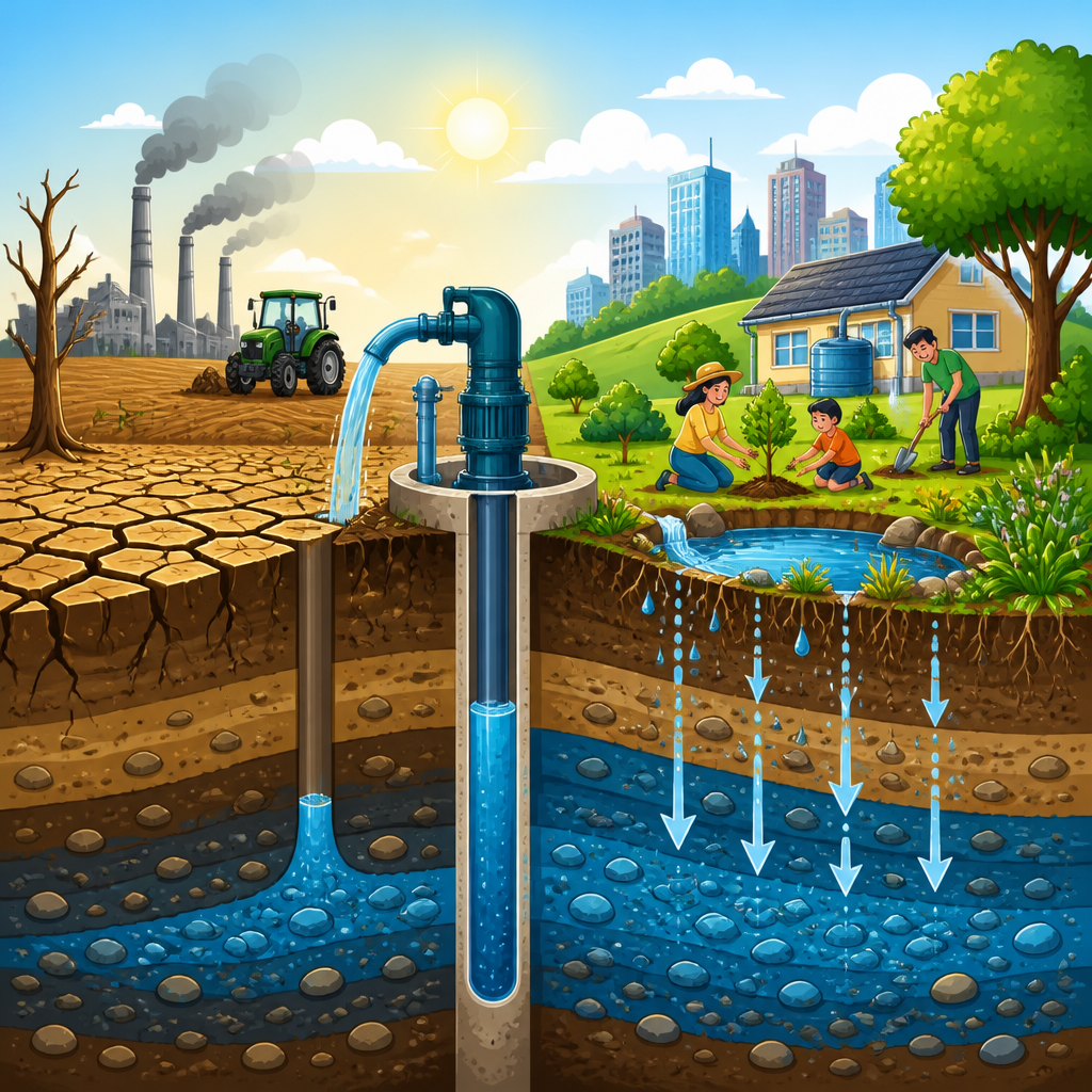
Groundwater depletion is one of the most serious and least visible environmental problems in modern water management. Groundwater is the water stored below Earth’s surface in the pores of soil, sand, gravel, and rock formations called aquifers. Depletion happens when water is pumped from an aquifer faster than rain, river seepage, snowmelt, and managed recharge can replace it. I have worked on water planning projects where wells that once produced reliable flows began failing within a decade, and the pattern is consistent across farming regions, growing cities, and industrial corridors. Because groundwater sits underground, communities often miss the warning signs until pumping costs rise, land starts sinking, wetlands shrink, or drinking water quality worsens.
This issue matters because groundwater supports nearly every part of soil and water science. It sustains irrigation in dry seasons, feeds springs and streams, stabilizes ecosystems, and provides drinking water for billions of people worldwide. In many regions, groundwater acts as a reserve during drought, buffering farms and cities when surface reservoirs run low. Yet that reserve is not unlimited. Understanding groundwater depletion requires linking hydrology, soil infiltration, watershed processes, land use, and policy. This hub article explains the causes, effects, and solutions in practical terms so readers can navigate the broader field of soil and water science with a clear foundation.
What Groundwater Depletion Means in Soil and Water Science
Groundwater moves through aquifers at rates that vary widely with geology. Coarse sand and gravel can transmit water relatively quickly, while clay-rich layers restrict movement. Soil science matters at the recharge stage: healthy, permeable soils allow rainfall to infiltrate, while compacted or sealed surfaces increase runoff and reduce replenishment. Water scientists distinguish between renewable groundwater, which is recharged on human time scales, and fossil groundwater, which accumulated over thousands of years and is effectively nonrenewable for present-day management. Depletion is not simply low water in a single well; it is a sustained decline in aquifer storage, pressure, or both across an area.
Aquifer behavior is measured through water levels, pumping rates, storage coefficients, transmissivity, and recharge estimates. In unconfined aquifers, the water table drops as storage declines. In confined aquifers, pressure can fall even before major storage losses become obvious at the surface. The effects depend on local conditions. A shallow alluvial aquifer beneath irrigated land behaves differently from a deep fractured-rock aquifer serving rural homes. That is why sound groundwater assessment combines borehole logs, monitoring wells, streamflow data, soil maps, pumping records, and climate trends rather than relying on a single indicator.
Primary Causes of Groundwater Depletion
The leading cause of groundwater depletion is overpumping for agriculture. Irrigation accounts for most freshwater withdrawals in many countries, and in dry regions farmers often depend on wells because groundwater is available on demand. High-water-use crops, long growing seasons, inefficient irrigation systems, and subsidized energy for pumping can accelerate withdrawals far beyond natural recharge. I have seen districts where a shift from seasonal grains to orchards locked growers into annual pumping because perennial crops cannot be fallowed easily during dry years. Once that transition happens, groundwater demand becomes structurally harder to reduce.
Urban growth is another major driver. Expanding cities need water for households, hospitals, schools, landscaping, and industry, and many turn to aquifers when rivers are overallocated or reservoirs are stressed. Industrial facilities may also pump heavily for cooling, processing, mining, or manufacturing. At the same time, urbanization reduces recharge because pavement, rooftops, and storm drains move rainfall away quickly instead of letting it soak into soil. Drought and climate change intensify the problem by reducing snowpack, shifting runoff timing, increasing evaporation, and driving emergency pumping when surface supplies shrink. Weak governance compounds all of this. Where wells are poorly monitored, pumping rights are unclear, or groundwater and surface water are regulated separately, depletion is far more likely.
How Soil, Land Use, and Climate Influence Recharge
Recharge is controlled by more than annual rainfall totals. Soil texture, structure, organic matter, slope, vegetation cover, and underlying geology determine how much water enters the ground and how much becomes runoff or evapotranspiration. Sandy soils usually infiltrate faster than clay soils, but compaction from heavy machinery can sharply reduce infiltration even on otherwise favorable land. In agricultural settings, bare soil may crust, causing storms to run off instead of soaking in. In forested watersheds, roots and litter often improve infiltration, though dense vegetation can also increase water use. There is no universal recharge rule; local water balance matters.
Land use changes often push recharge downward. Wetlands that once stored and slowly released water may be drained. Floodplains may be leveed, preventing rivers from spreading and percolating into alluvial aquifers. Urban stormwater systems are designed for rapid drainage, not infiltration. Even where rainfall is stable, hotter temperatures can lower effective recharge because more water returns to the atmosphere. Snow-dominated basins are especially sensitive: earlier melt can reduce late-season streamflow and increase reliance on groundwater in summer. These connections show why groundwater depletion belongs within a full soil and water science framework rather than a narrow well-management discussion.
Environmental and Economic Effects of Depletion
The most immediate effect of groundwater depletion is declining well yield and rising pumping cost. As water levels fall, pumps must lift water farther, which increases energy use and operating expense. Shallow domestic wells are often the first to fail, creating equity problems because low-income rural households usually cannot afford deepening or replacement. Municipal systems may need expensive wellfield expansion, treatment upgrades, or imported water. Farmers face lower profit margins, crop stress, and difficult choices about land retirement. In severe cases, aquifers that once supported regional prosperity become a source of chronic financial risk.
Environmental impacts are equally serious. Groundwater and surface water are hydraulically connected in many basins, so heavy pumping can reduce baseflow to rivers, dry up springs, and damage wetlands. Habitat loss follows, affecting fish, amphibians, riparian plants, and migratory birds. Falling groundwater can also trigger land subsidence when fine-grained sediments compact after pore pressure drops. California’s San Joaquin Valley has documented meters of subsidence in some areas, damaging canals, roads, and flood-control infrastructure. Along coasts, overpumping can invite saltwater intrusion, making freshwater wells brackish. Water quality may deteriorate inland too, as deeper saline water, arsenic, fluoride, or nitrate contamination becomes more difficult to manage under stressed conditions.
Where Groundwater Depletion Is Happening Now
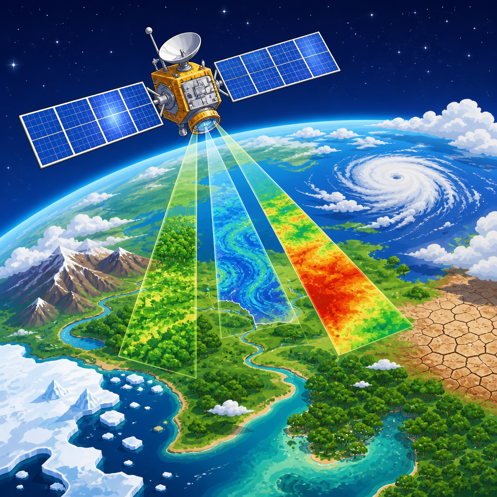
Groundwater depletion is a global pattern, not a local anomaly. The Ogallala Aquifer in the central United States has experienced long-term declines from irrigation, especially in parts of Texas and Kansas. Northern India has seen major groundwater losses tied to intensive pumping for rice and wheat production, supported in some areas by low-cost electricity. The North China Plain, the Middle East, Iran, and parts of Spain and Australia also show persistent pressure on aquifers. Satellite data from NASA’s GRACE missions have helped confirm large-scale storage losses by measuring changes in Earth’s gravity field linked to water mass.
These examples differ in climate and governance, but the mechanism is familiar: withdrawals exceed recharge for years. The local consequences then reflect geology and land use. In arid agricultural basins, depletion often appears first as deeper pumping and falling profitability. In rapidly urbanizing basins, competition among cities, farms, and ecosystems becomes sharper. In coastal settings, salinity risk moves to the forefront. Studying these cases is useful because they show that depletion is manageable when monitoring, pricing, crop choice, recharge planning, and enforcement improve together. No single intervention reverses a basin-wide overdraft on its own.
How Scientists Measure and Monitor Groundwater Decline
Reliable management starts with measurement. The core tools are monitoring wells, pumping records, aquifer tests, stream gauges, water-quality sampling, and remote sensing. Water level hydrographs reveal seasonal patterns and long-term decline. Pumping tests estimate transmissivity and storativity, helping hydrogeologists predict drawdown. Numerical groundwater models such as MODFLOW are widely used to simulate scenarios, including drought, land use change, and managed aquifer recharge. In agricultural regions, evapotranspiration estimates from satellite imagery can improve water budgets by showing how much water crops actually consume.
| Method | What it measures | Why it matters |
|---|---|---|
| Monitoring wells | Water level changes over time | Shows drawdown, recovery, and long-term trends |
| Pumping records | Withdrawal volumes by well or sector | Links demand to aquifer response |
| Water-quality tests | Nitrate, salinity, arsenic, fluoride, and more | Reveals quality risks that rise during depletion |
| Stream gauges | Baseflow and river-aquifer interaction | Detects ecological impacts of heavy pumping |
| Satellite gravity data | Regional water storage change | Tracks basin-scale depletion beyond local wells |
| Groundwater models | Future behavior under management scenarios | Supports planning, permits, and recharge design |
Good monitoring systems also connect groundwater to soils and landscapes. Soil moisture sensors, infiltration tests, lysimeters, and land cover mapping help explain why some areas recharge well and others do not. The best programs publish data regularly so farmers, utilities, researchers, and regulators are working from the same evidence. That transparency reduces conflict and improves compliance because users can see the trend lines clearly.
Practical Solutions for Sustainable Groundwater Management
Effective solutions combine demand reduction, recharge enhancement, and enforceable governance. On the demand side, irrigation efficiency matters, but it must be evaluated carefully. Drip systems, improved scheduling, soil moisture monitoring, and deficit irrigation can reduce withdrawals, yet efficiency alone does not guarantee aquifer recovery if farmers expand acreage or switch to thirstier high-value crops. The stronger approach is basin accounting: set measurable extraction limits, meter wells, align pumping with recharge, and create drought rules before crisis conditions arrive. Urban areas can reduce pressure through leak control, water-efficient fixtures, industrial recycling, and landscape standards that favor climate-appropriate planting.
Recharge can be increased through managed aquifer recharge projects that spread water in basins, inject it through wells, or route high flows onto fields and floodplains where geology permits infiltration. Stormwater capture, permeable pavements, recharge parks, restored wetlands, and soil health practices such as reduced tillage and cover crops can improve infiltration locally. Policy is the deciding factor. Successful groundwater management requires clear rights, real-time data, pricing or incentives that discourage waste, and coordination between surface water and groundwater management. Start with measurement, protect recharge zones, and support local conservation programs that keep aquifers usable for the next generation.
Frequently Asked Questions
What is groundwater depletion, and why is it such a serious problem?
Groundwater depletion happens when water is withdrawn from underground aquifers faster than natural processes can refill them. Aquifers are the layers of soil, sand, gravel, and rock that store water beneath the surface, and they function like long-term natural reservoirs. Under healthy conditions, rainfall, snowmelt, river seepage, and managed recharge slowly replenish these supplies. When pumping consistently exceeds that recharge, water levels drop, wells must be drilled deeper, pumping costs rise, and in some cases the aquifer can be damaged in ways that are difficult or impossible to reverse.
This is such a serious problem because groundwater supports drinking water systems, agriculture, industry, and ecosystems, often without attracting much public attention. Unlike a dry river or shrinking lake, aquifer decline is mostly invisible until the impacts become severe. Communities may not notice the warning signs until domestic wells begin failing, farms face water shortages, land starts sinking, or connected streams and wetlands lose flow. In many regions, groundwater acts as a drought buffer, so when it is depleted, resilience to climate variability falls sharply. That combination of invisibility, slow buildup, and high dependence is what makes groundwater depletion one of the most important water management challenges today.
What are the main causes of groundwater depletion?
The most common cause is overpumping, especially for irrigation. In many agricultural areas, groundwater makes high-value crop production possible, but repeated withdrawals over many years can outpace recharge. This is especially true in dry and semi-arid regions where rainfall is limited and where aquifers refill very slowly. Municipal growth is another major factor. As cities expand, demand for drinking water, landscaping, commercial use, and industrial activity increases, placing more pressure on nearby groundwater sources.
Land use change also plays an important role. Urban development often replaces open land with pavement and rooftops, which reduces the amount of water that can soak into the ground. River channel modification, wetland loss, and deforestation can alter recharge patterns as well. Climate change can worsen the problem by shifting snowpack, reducing reliable precipitation, increasing evapotranspiration, and intensifying drought. In some places, groundwater governance is also part of the cause. Weak monitoring, unclear pumping rights, limited enforcement, and underpriced water can encourage extraction without adequate long-term planning. In short, depletion usually results from a combination of heavy demand, reduced recharge, and insufficient management.
What are the environmental and economic effects of groundwater depletion?
The environmental effects can be extensive. As groundwater levels decline, streams, springs, and wetlands that depend on subsurface flow may lose water or disappear entirely. That can harm fish, birds, amphibians, riparian vegetation, and other species that rely on groundwater-fed habitats. In coastal areas, depletion can allow saltwater to move inland into freshwater aquifers, making water supplies harder or more expensive to use. In some regions, severe pumping can also trigger land subsidence, which is the gradual sinking of the ground as water is removed from compactable sediments. Subsidence can permanently reduce aquifer storage capacity and damage roads, canals, pipelines, and buildings.
The economic effects are equally serious. Households and utilities may need to deepen wells, replace pumps, or develop new water sources, all of which can be expensive. Farmers often face higher energy costs as water levels fall because it takes more power to lift water from greater depths. Reduced well productivity can lower crop reliability, increase financial risk, and affect local food production. Businesses that depend on stable water supplies may also face rising costs or interruptions. Over time, groundwater depletion can shift costs from gradual management to emergency response, and that is almost always the more expensive path. What begins as a hidden drop in water levels can eventually become a broad infrastructure, economic, and environmental challenge.
How can groundwater depletion affect private wells and local communities?
Private well owners are often among the first to feel the impact of declining groundwater levels. When the water table drops below the depth a well was designed to reach, that well may produce less water, become unreliable, or stop working entirely. This can happen gradually, with lower pressure and slower recovery, or suddenly during peak summer demand or drought. For homeowners, the consequences can be immediate and costly: drilling a deeper well, lowering a pump, installing storage, or connecting to a public system can require major unplanned expenses.
At the community level, groundwater depletion can create inequities. Larger municipal or agricultural users may have the resources to deepen wells or secure alternative supplies, while rural households and small communities may not. Water quality can also worsen as levels decline, sometimes concentrating naturally occurring contaminants or drawing in poorer-quality water from surrounding areas. Schools, small businesses, and local fire protection can all be affected if water supply reliability drops. Beyond the financial burden, there is also a social cost. Communities that once depended on stable local groundwater can lose confidence in their water future, and local planning becomes more difficult. That is why early monitoring and coordinated management matter so much: they help communities respond before well failures become widespread.
What are the best solutions for reducing or preventing groundwater depletion?
The most effective solutions combine demand reduction, recharge improvement, and stronger groundwater governance. On the demand side, agriculture can shift to more efficient irrigation methods, better soil moisture monitoring, deficit irrigation strategies where appropriate, and crop choices that align better with local water availability. Cities can reduce pressure through leak detection, water-efficient fixtures, drought-tolerant landscaping, reuse programs, and conservation pricing structures. Industries can also recycle process water and improve efficiency. These measures do not eliminate the need for groundwater, but they can significantly slow the rate of decline.
On the supply and management side, managed aquifer recharge is an important tool. This can include spreading basins, infiltration fields, stormwater capture, floodwater recharge, and operational strategies that direct excess surface water underground when conditions allow. Protecting open land and recharge zones also helps more water soak into the ground naturally. Equally important is governance: measuring groundwater levels, tracking pumping, setting sustainable withdrawal targets, coordinating surface water and groundwater planning, and enforcing clear rules. The best long-term approach is not to treat groundwater as an unlimited reserve, but as a shared asset that must be balanced over time. When communities pair good data with practical conservation and recharge efforts, they have the best chance of protecting aquifers for future generations.