
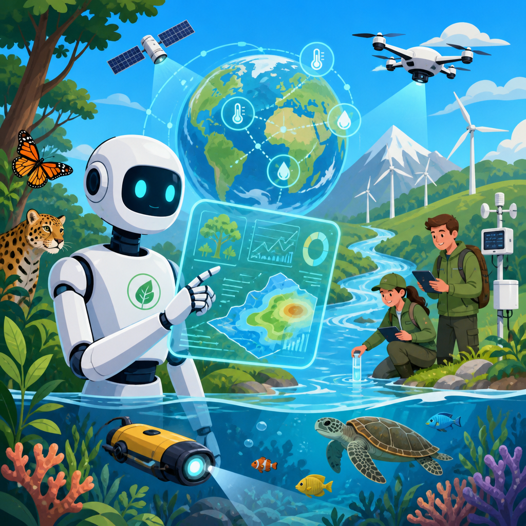
Artificial intelligence is transforming environmental science by accelerating research, improving monitoring, and uncovering patterns that human analysts would miss in massive ecological datasets. In environmental science, AI usually refers to machine learning, deep learning, computer vision, natural language processing, and optimization systems that detect relationships in data, generate forecasts, classify images, and support decisions. Research and discoveries in this field span climate modeling, biodiversity tracking, pollution detection, water management, wildfire prediction, and conservation planning. As someone who has worked with environmental datasets, satellite imagery, and model validation workflows, I have seen how AI changes the pace of discovery: analyses that once took weeks of manual labeling or statistical processing can now be completed in hours, often with better spatial coverage and repeatability.
This matters because environmental science faces a scale problem. Earth systems are complex, interconnected, and constantly changing, while the available data streams are expanding rapidly through satellites, drones, sensor networks, genomic sequencing, acoustic monitors, and digitized scientific literature. Traditional methods remain essential, but they can struggle when researchers need to classify millions of land cover pixels, identify endangered species from thousands of camera trap images, or estimate air quality block by block across a city. AI helps convert raw observations into usable evidence. It does not replace field science, chemistry, hydrology, or ecology. Instead, it strengthens them by finding signal in noise, prioritizing where experts should look, and integrating information collected at different times and scales.
For a sub-pillar hub focused on research and discoveries, the key question is not whether AI belongs in environmental science, but where it produces the most reliable value. The answer is across the research lifecycle: data collection, preprocessing, pattern recognition, forecasting, hypothesis generation, and decision support. The strongest applications combine established scientific methods with transparent model training, independent validation, and domain expertise. When those elements are in place, AI can improve scientific productivity, reveal previously hidden trends, and support environmental action grounded in evidence rather than intuition.
How AI improves environmental data collection and analysis
Environmental science depends on observation, and AI expands what researchers can observe consistently. Remote sensing is the clearest example. Agencies such as NASA and the European Space Agency produce continuous streams of multispectral and radar imagery from programs including Landsat, Sentinel, and MODIS. Convolutional neural networks and random forest models can classify forests, wetlands, croplands, burned areas, and urban expansion with speed and accuracy that would be impossible through manual interpretation alone. In practical projects, I have seen researchers use Google Earth Engine with TensorFlow or XGBoost to detect shoreline change, invasive plant spread, and drought stress across multi-year image archives. These workflows allow environmental scientists to move from isolated case studies to regional and global monitoring.
Sensor networks create another layer of opportunity. Air quality stations, stream gauges, soil moisture probes, ocean buoys, weather stations, and low-cost community sensors produce time-series data with gaps, drift, and anomalies. AI models are valuable because they can clean and harmonize these records, detect instrument failure, and estimate conditions in locations without direct measurement. For example, machine learning can combine traffic density, meteorological data, and stationary sensor readings to estimate particulate matter exposure at neighborhood scale. In water research, recurrent neural networks and gradient boosting models are commonly used to predict nutrient loads, dissolved oxygen, or harmful algal bloom conditions from hydrologic and weather data. These are not abstract gains. Better estimates mean better sampling plans, stronger public health alerts, and more defensible policy analysis.
Natural language processing is also reshaping literature review and evidence synthesis. Environmental research is spread across journals, technical reports, regulatory filings, biodiversity records, and historical archives. AI tools can extract named entities, classify documents by topic, summarize trends, and identify understudied regions or pollutants. That helps teams map what is known before launching expensive field campaigns. The limitation is that text models inherit the quality and bias of the literature they ingest, so expert review remains mandatory. Still, for a research hub covering discoveries, this capability is significant: AI is not only helping scientists analyze nature, but also helping them analyze the scientific record itself.
Climate and weather research: faster models, sharper forecasts
AI is transforming climate and weather research by improving emulation, downscaling, and anomaly detection. Traditional climate models based on physical equations remain the scientific foundation for understanding atmospheric and oceanic processes. However, these models are computationally intensive, especially when researchers need many scenarios or fine spatial resolution. AI can act as an emulator that approximates parts of these systems, reducing runtime while preserving useful predictive skill for selected applications. Researchers use neural networks to emulate cloud processes, estimate radiative transfer, or accelerate parameterization tasks that otherwise slow Earth system simulations. This does not eliminate physical modeling; it makes certain experiments more feasible and broadens exploratory research.
Downscaling is one of the most practical uses. Global climate models may be too coarse for local flood planning, crop risk studies, or urban heat assessments. Machine learning methods can connect large-scale atmospheric variables to local observations, producing higher-resolution temperature, precipitation, or wind estimates. For instance, scientists have used deep learning to refine wildfire weather conditions in complex terrain and to identify heat island intensity within cities where building materials, tree canopy, and street geometry matter. Forecasting extremes is especially important because societal impacts often come from tail events rather than averages. AI can improve detection of atmospheric rivers, cyclones, flash droughts, and severe rainfall signatures in satellite and reanalysis datasets.
There are tradeoffs. A highly accurate forecast model is not automatically a strong scientific explanation. Environmental researchers must ask whether a model is physically plausible, whether it generalizes outside its training range, and whether uncertainty is quantified. In climate science, that means using hindcasting, cross-validation across regions and years, ensemble methods, and comparison with known physical relationships. The best research treats AI outputs as one line of evidence within a broader framework that includes process understanding and independent measurements.
Biodiversity, conservation, and ecosystem monitoring
AI has become indispensable in biodiversity research because ecological monitoring now generates huge volumes of images, sounds, DNA sequences, and habitat maps. Camera traps alone can produce millions of wildlife images in a single project. Computer vision models identify species, count individuals, and flag rare detections for expert review. Conservation groups and research labs use tools such as Wildlife Insights, MegaDetector, and custom PyTorch models to process these datasets efficiently. In field operations, this changes staffing patterns dramatically. Instead of spending months sorting empty frames or common species, ecologists can focus on occupancy modeling, movement ecology, and management implications.
Bioacoustics is another major discovery engine. Forests, wetlands, and oceans can be monitored continuously using passive acoustic sensors. AI models detect bird songs, frog calls, bat echolocation, whale vocalizations, chainsaw noise, or vessel traffic. This is particularly valuable in inaccessible habitats where repeated field visits are expensive or disruptive. I have seen acoustic classification projects reveal seasonal species presence that standard daytime surveys missed entirely. The same approach is now used to estimate ecosystem condition by measuring soundscape diversity and anthropogenic disturbance. Combined with geospatial analysis, it gives researchers a dynamic picture of habitat quality across time.
Genomics and environmental DNA add further depth. Water, soil, and air samples can contain genetic traces from organisms that are difficult to observe directly. AI supports sequence classification, taxonomic assignment, and pattern discovery within large biodiversity datasets. This helps identify invasive species earlier, track pathogens, and assess community shifts under pollution or climate stress. Conservation planning then integrates these signals with land use maps, protected area boundaries, connectivity models, and socioeconomic constraints to prioritize interventions. The result is more targeted action, whether the goal is preserving migration corridors, restoring wetlands, or reducing bycatch in marine systems.
| Research area | Common AI methods | Typical data sources | Research benefit |
|---|---|---|---|
| Land cover change | Random forest, CNNs | Satellite imagery, lidar | Faster habitat and deforestation mapping |
| Wildlife monitoring | Computer vision, object detection | Camera traps, drones | Automated species identification and counting |
| Acoustic ecology | Audio classification, spectrogram CNNs | Passive recorders, hydrophones | Continuous detection of species and disturbance |
| Water quality | Gradient boosting, LSTMs | Sensors, weather, lab samples | Earlier warning of bloom or contamination risk |
| Climate impacts | Downscaling, anomaly detection | Reanalysis, station data, models | Localized forecasts for adaptation planning |
Pollution, water, and public health discoveries
Some of the most immediately useful AI applications in environmental science involve pollution research and exposure assessment. Air pollution varies sharply across space and time, but fixed monitoring stations are sparse. Machine learning bridges that gap by combining station measurements with satellite aerosol optical depth, weather variables, road networks, industrial emissions, and land use features. Researchers use these models to estimate PM2.5, nitrogen dioxide, ozone, and black carbon at much finer resolution than monitoring networks alone allow. Those estimates support epidemiology studies linking exposure to asthma, cardiovascular disease, birth outcomes, and cognitive effects. Better exposure maps produce better science because they reduce misclassification in health analyses.
Water research is moving in the same direction. Nutrient pollution, sediment transport, salinity intrusion, and pathogen outbreaks are highly dynamic, especially under variable rainfall and land management. AI models can identify the combinations of precipitation, upstream discharge, fertilizer application, soil type, and temperature that precede harmful algal blooms or fish kills. Remote sensing also helps. Chlorophyll concentration, turbidity, thermal anomalies, and surface extent can be estimated from satellite imagery, then linked to in situ observations through supervised learning. Utilities and watershed managers use this work to improve reservoir operations, target inspection resources, and evaluate best management practices.
Environmental justice research benefits as well. AI can reveal where pollution burdens overlap with vulnerable populations, aging infrastructure, heat exposure, and limited healthcare access. That makes scientific findings more actionable. Still, these analyses require care. Proxy variables can encode social bias, low-cost sensors can introduce measurement error, and black-box models may be difficult to defend in regulatory contexts. Strong studies therefore document data provenance, calibration procedures, confidence intervals, and fairness considerations alongside model performance metrics.
Limits, risks, and the standards that make AI trustworthy
AI in environmental science is powerful, but it is not automatically reliable. The most common failure point is poor training data. A model trained on one region, season, or instrument type may fail when conditions change. Class imbalance is another issue: rare species, rare floods, or unusual pollution events are often the very outcomes researchers care about most, yet they may be underrepresented in the data. Overfitting, spurious correlations, and data leakage can create impressive validation scores that collapse in real deployment. That is why credible environmental AI research uses holdout sets, external validation, uncertainty estimates, and comparison against baseline methods such as generalized linear models or physically based models.
Interpretability matters too. In many projects, I have found that the best-performing model is not always the most useful scientific tool. Researchers often need to know which features drove a prediction and whether those relationships make environmental sense. Methods such as SHAP values, partial dependence plots, permutation importance, and error analysis by region or season can expose model behavior. Standards and reproducibility practices also matter. Version-controlled code, documented preprocessing, open training data where possible, and reporting guidance similar to established machine learning transparency frameworks improve confidence and reuse.
There is also an environmental cost to consider. Large AI models can require significant computational resources and energy, especially during training. In environmental science, efficiency should be part of model selection. A lighter model that is easier to interpret and deploy may be preferable to a marginally better but resource-intensive alternative. The field is strongest when AI is used with discipline: matched to the question, validated rigorously, and integrated with field knowledge rather than treated as magic.
Where research and discoveries are heading next
The next phase of AI in environmental science will center on multimodal research, real-time monitoring, and stronger links between prediction and decision-making. Multimodal systems combine imagery, sensor time series, text, climate records, topography, and biological data in a single analytical workflow. That is important because environmental processes rarely appear in one data type alone. A wetland restoration study, for example, may integrate drone imagery, water level sensors, bird acoustics, and historical management records to assess recovery. As foundation models mature for geospatial and scientific data, researchers will be able to adapt pretrained systems to specialized tasks with less labeled data, speeding discoveries in understudied regions.
At the same time, AI will become more embedded in operational environmental science. Early warning systems for wildfire risk, flood impacts, coral bleaching, illegal fishing, and methane leakage are already improving. The most valuable advances will not be the most glamorous ones, but the ones that combine robust science with usable delivery: dashboards that explain uncertainty, models that update as new data arrives, and workflows that let agencies act before damage spreads. For this Environmental Science hub, the takeaway is clear. AI is transforming research and discoveries by turning overwhelming data into interpretable evidence, helping scientists ask better questions, test them faster, and protect natural systems more effectively. Explore the linked articles in this subtopic to go deeper into climate research, biodiversity monitoring, pollution science, and conservation technology.
Frequently Asked Questions
1. What does AI actually do in environmental science?
AI helps environmental scientists work faster, at larger scales, and with greater precision by finding meaningful patterns in complex datasets that would be difficult or impossible to analyze manually. In practice, this includes using machine learning to identify relationships in climate records, deep learning to recognize features in satellite imagery, computer vision to monitor forests, coastlines, or wildlife populations, and natural language processing to organize scientific literature, policy documents, and field reports. AI can also support optimization tasks, such as improving energy use, water management, land-use planning, and conservation strategies.
What makes AI especially valuable in environmental science is the sheer volume and variety of data involved. Researchers often work with satellite observations, drone imagery, weather station records, ocean sensor data, biodiversity surveys, pollution measurements, and historical climate archives all at once. AI systems can integrate these sources, detect hidden trends, and generate forecasts that help scientists understand changing ecosystems and environmental risks. Rather than replacing environmental experts, AI acts as a powerful analytical tool that expands their ability to monitor the planet, test hypotheses, and make informed decisions.
2. How is AI improving climate modeling and forecasting?
AI is improving climate modeling by helping researchers process massive atmospheric and oceanic datasets more efficiently and by identifying nonlinear relationships that traditional statistical approaches may miss. Climate systems are shaped by interactions among temperature, cloud cover, ocean circulation, land surfaces, greenhouse gases, and human activity, which makes forecasting extremely complex. AI models can be trained on historical weather and climate data to detect recurring patterns, refine regional predictions, and improve short- and medium-term forecasts related to heat waves, heavy rainfall, drought, storms, and seasonal climate variability.
Another major advantage is speed. Traditional climate simulations can be computationally expensive and time-intensive, especially at high resolution. AI can complement these models by accelerating specific components, filling data gaps, and creating surrogate models that approximate certain physical processes more quickly. This allows scientists to run more scenarios, compare risks across regions, and evaluate the likely effects of policy choices or land-use changes. While AI does not replace physics-based climate models, it increasingly strengthens them by improving precision, scalability, and responsiveness in a field where timely insights are critical.
3. In what ways is AI used for monitoring ecosystems, wildlife, and pollution?
AI is playing a major role in environmental monitoring by turning raw observations into actionable insights. For ecosystems and land cover, computer vision models can analyze satellite and drone imagery to detect deforestation, wetland loss, coral bleaching, wildfire damage, crop stress, coastal erosion, and urban expansion. In wildlife research, AI can identify species from camera trap images, acoustic recordings, and even movement patterns, making it easier to estimate population trends, migration timing, and habitat use. This greatly reduces the time researchers spend reviewing thousands or millions of observations by hand.
AI is also valuable for pollution tracking and public health protection. Machine learning models can combine air quality sensor data, traffic information, meteorological conditions, and industrial emissions records to forecast pollution events and identify likely sources. Similar approaches are used for water quality monitoring, including detecting harmful algal blooms, sediment plumes, or contamination risks. Because these systems can operate continuously and at scale, they support earlier warnings, more targeted interventions, and better long-term environmental management. The result is a more dynamic and responsive monitoring system than traditional methods alone can usually provide.
4. What are the biggest benefits and limitations of using AI in environmental research?
The biggest benefits of AI in environmental research are speed, scale, pattern recognition, and predictive power. AI can rapidly analyze enormous datasets collected across long time periods and wide geographic areas, which is essential in fields such as climate science, ecology, hydrology, and atmospheric research. It can uncover subtle correlations, classify imagery with high consistency, automate repetitive tasks, and help researchers prioritize where to focus fieldwork or intervention efforts. This often leads to more efficient research workflows, improved forecasting, and stronger evidence for environmental planning and policy.
At the same time, AI has important limitations. Its accuracy depends heavily on the quality, completeness, and representativeness of the data used to train it. If a model is trained on biased, outdated, or regionally narrow data, its conclusions may be unreliable when applied elsewhere. Many AI systems also function as “black boxes,” meaning they can produce strong predictions without making their reasoning easy to interpret. In environmental science, that can be a serious challenge when researchers need transparent, explainable results. In addition, AI requires computational resources, technical expertise, and careful validation against real-world observations. The most effective use of AI comes when it is combined with domain knowledge, field science, and established physical models rather than treated as a standalone solution.
5. Will AI replace environmental scientists, or change how they work?
AI is far more likely to change the work of environmental scientists than replace them. Environmental science depends on interpretation, field expertise, experimental design, ethical judgment, and an understanding of natural systems that goes well beyond pattern detection. AI can sort images, generate forecasts, flag anomalies, and summarize large bodies of information, but it does not independently define research questions, understand local ecological context in a human sense, or make value-based decisions about conservation priorities, environmental justice, or risk tradeoffs. Scientists are still essential for framing problems, validating results, and deciding how findings should influence action.
What AI does change is the pace and scope of scientific work. Researchers can automate labor-intensive data processing, spend less time on manual classification, and devote more effort to interpretation, hypothesis testing, cross-disciplinary collaboration, and decision support. This shift may also create demand for new skills, including data science, model evaluation, geospatial analysis, and responsible AI use. In that sense, AI is becoming an increasingly important partner in environmental science: a tool that enhances human capability, expands what can be measured and predicted, and helps scientists respond more effectively to urgent environmental challenges.


