
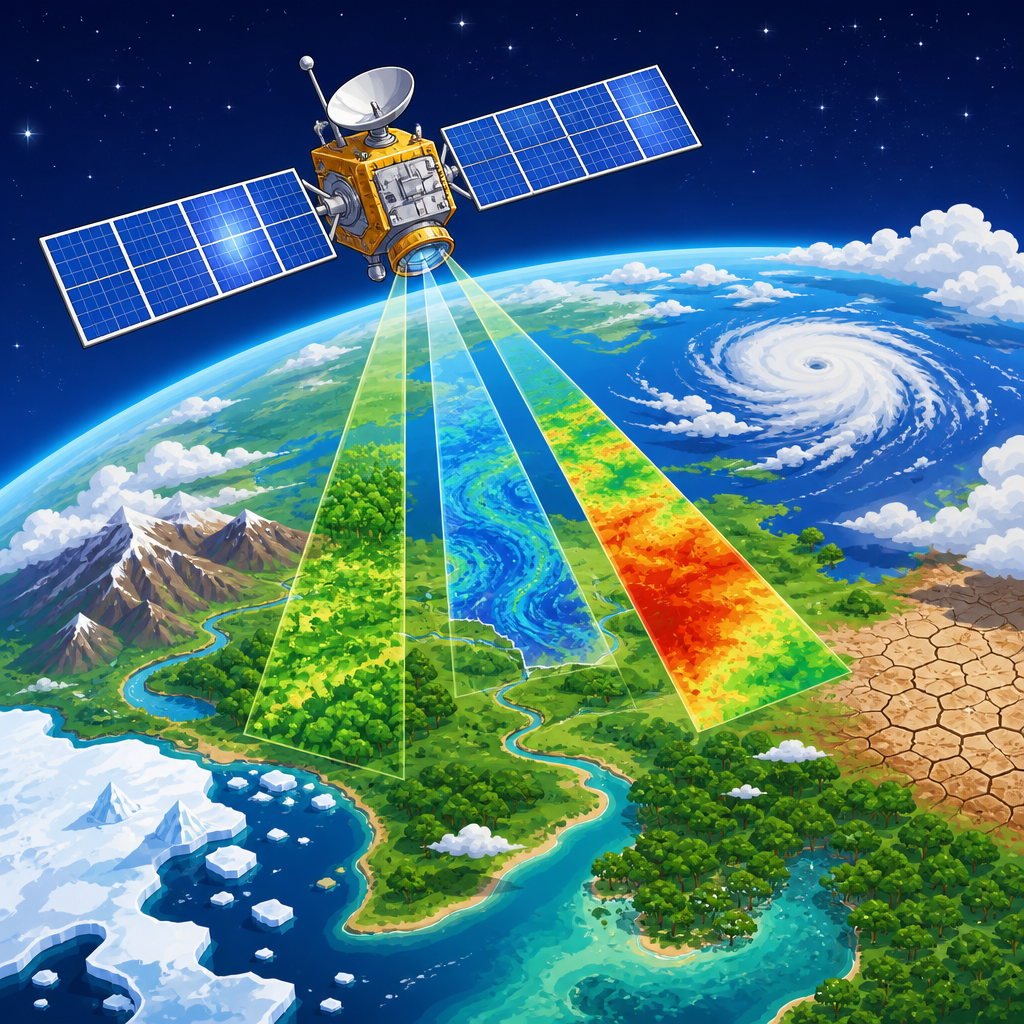
New satellite technologies are changing how scientists observe climate systems, track environmental change, and turn raw measurements into decisions that protect lives, infrastructure, and ecosystems. In environmental science, Earth monitoring refers to the continuous collection of information about the atmosphere, oceans, land, ice, and biosphere, while climate monitoring focuses on long-term patterns such as warming trends, greenhouse gas concentrations, sea level rise, and shifting precipitation. The newest generation of satellites matters because it expands both coverage and precision: instruments now detect methane plumes from individual facilities, map soil moisture through clouds, measure sea surface height to centimeters, and revisit the same location many times per day. I have worked with satellite-derived land and climate datasets in planning and research settings, and the practical difference between older, sparse observations and today’s dense streams of data is dramatic. Better satellites produce better baselines, earlier warnings, stronger climate models, and more credible evidence for policy, insurance, agriculture, disaster response, and conservation. As a research and discoveries hub within environmental science, this article explains the technologies behind modern climate and Earth observation, what each sensor class measures best, where the leading missions are pushing the field, and why combining satellite records with ground truth remains essential for trustworthy conclusions and action.
Optical and thermal imaging satellites: the foundation of modern Earth observation
Optical satellites remain the most familiar Earth monitoring tools because they produce images that resemble photographs, but modern systems extract far more than pictures. Multispectral and hyperspectral sensors separate reflected sunlight into specific wavelength bands, allowing scientists to distinguish healthy vegetation from stressed crops, burned areas from bare soil, sediment-rich water from clear water, and urban heat islands from surrounding landscapes. Thermal infrared instruments add surface temperature, which is critical for drought analysis, wildfire behavior, glacier melt studies, and heat risk mapping. NASA’s Landsat program, operating since 1972, created one of the most valuable continuous environmental records on Earth. Landsat 8 and 9 provide 30-meter multispectral data and 100-meter thermal measurements, useful for decades-scale land cover change analysis. The European Space Agency’s Sentinel-2 pair improves revisit frequency with 10- to 20-meter resolution and bands tailored for vegetation and coastal monitoring. In practice, researchers often combine Landsat’s long archive with Sentinel-2’s frequent updates to study forest loss, wetland dynamics, and urban expansion with both historical depth and current detail.
Thermal missions are becoming more specialized as heat itself becomes a major climate indicator. The ECOSTRESS instrument on the International Space Station measures plant temperature and water stress at different times of day, revealing how ecosystems respond to heat waves. That timing matters because midday and nighttime heat produce different impacts on crops, human health, and energy demand. Hyperspectral missions are also opening new research frontiers. Italy’s PRISMA and Germany’s EnMAP capture hundreds of spectral channels, enabling finer detection of mineral composition, algal blooms, vegetation chemistry, and post-fire recovery. Future missions such as NASA’s Surface Biology and Geology will strengthen this capability. The limitation of optical and thermal systems is straightforward: clouds, smoke, and darkness reduce or block observations. That is why no serious climate monitoring strategy relies on optical imagery alone. Still, for visible land change, habitat condition, water color, and temperature patterns, these satellites remain the baseline against which many other environmental products are interpreted.
Radar satellites and microwave sensing: seeing through clouds and measuring structure
Radar and microwave satellites solve one of the oldest problems in Earth observation by collecting data day or night and through most cloud cover. Synthetic aperture radar, usually shortened to SAR, transmits microwave pulses and measures the returning signal, revealing surface roughness, moisture conditions, and structural change. In flood emergencies, radar often becomes the primary mapping source because storm clouds that hide optical imagery do not stop microwave observations. The Sentinel-1 mission has been central for flood extent mapping, sea ice tracking, landslide detection, and deformation monitoring around volcanoes, dams, and cities. Scientists use interferometric SAR, or InSAR, to compare repeated radar passes and detect ground movement at millimeter scale. That capability has transformed hazard research by showing gradual subsidence in groundwater-depleted basins, uplift before volcanic eruptions, and infrastructure instability before visible failure.
Microwave radiometers measure naturally emitted radiation rather than active radar returns. These sensors are especially valuable for variables that are difficult to observe directly at large scales, including soil moisture, snow water equivalent, sea ice concentration, and precipitation. NASA’s SMAP mission combines microwave measurements with modeling to estimate near-surface soil moisture globally, supporting drought monitoring, crop forecasting, and flood prediction. The Global Precipitation Measurement mission, a partnership led by NASA and JAXA, uses a core observatory and partner satellites to estimate rain and snow worldwide with far better temporal coverage than earlier systems. For climate studies, microwave records are powerful because they are less affected by atmospheric interference than visible wavelengths and can preserve consistency across long periods. Tradeoffs exist: radar processing is technically demanding, data files are large, and interpretation is less intuitive for non-specialists than standard imagery. Even so, for all-weather monitoring, polar regions, disaster response, and measurements of physical structure rather than simple appearance, radar and microwave technologies are among the most important advances in environmental science.
Atmospheric monitoring from orbit: greenhouse gases, aerosols, and air quality
Some of the most significant new satellite technologies focus not on the surface, but on the composition of the atmosphere itself. Modern spectrometers detect gases by measuring how molecules absorb and emit radiation at characteristic wavelengths. This approach supports direct monitoring of carbon dioxide, methane, nitrogen dioxide, sulfur dioxide, ozone, and aerosols. The European Sentinel-5P mission, carrying the TROPOMI instrument, demonstrated how transformative daily global atmospheric mapping can be. Researchers now identify urban pollution signatures, track wildfire smoke across continents, and quantify methane hotspots from oil and gas basins, coal mines, and landfills. Methane deserves special attention because, over a 20-year period, it traps far more heat per molecule than carbon dioxide. New missions such as GHGSat’s commercial constellation and the Environmental Defense Fund’s MethaneSAT are designed to detect and attribute emissions with facility-scale relevance, closing the gap between national inventories and real-world releases.
Atmospheric monitoring satellites also improve climate model evaluation. Aerosols, for example, can cool or warm the atmosphere depending on particle type, altitude, and underlying surface reflectivity. Instruments such as MODIS, VIIRS, and CALIPSO have built long records of aerosol optical depth, cloud properties, and vertical structure. These measurements help scientists test assumptions about cloud feedbacks, radiative forcing, and the transport of dust or smoke. During major wildfire seasons in North America and Australia, satellite aerosol observations have shown how smoke alters regional weather, reduces air quality thousands of kilometers away, and changes the amount of sunlight reaching the ground. For policy and enforcement, higher resolution matters because coarse averages can hide point sources. When a satellite can resolve a concentrated methane plume over a pipeline network or landfill cell, regulators and operators can prioritize repairs quickly. The strongest current trend is not simply more atmospheric data, but more actionable atmospheric data tied to identifiable places, sectors, and events.
Ocean, ice, and water cycle missions: tracking the planet’s most dynamic systems
Climate monitoring depends heavily on measuring the oceans and cryosphere because they store heat, drive weather, and signal long-term change. Satellite altimeters have provided one of the clearest records of rising global mean sea level. Beginning with TOPEX/Poseidon and continuing through the Jason series and Sentinel-6 Michael Freilich, radar altimetry measures sea surface height with extraordinary accuracy. Since 1993, the observed rate of global mean sea level rise has been about 3 to 4 millimeters per year, with acceleration evident in the record. That rise reflects both thermal expansion and land ice loss. Newer missions extend beyond the open ocean. SWOT, the Surface Water and Ocean Topography mission, uses Ka-band radar interferometry to map water surface height and extent across rivers, lakes, reservoirs, wetlands, and coastal zones with far finer spatial detail than traditional nadir altimeters. For hydrology research, this is a major breakthrough because inland water storage has long been under-observed at continental scales.
Ice monitoring has also advanced sharply. CryoSat-2, ICESat-2, and Sentinel-1 together support measurements of sea ice thickness, glacier velocity, ice sheet elevation change, and grounding line movement. Laser altimetry from ICESat-2 is especially useful for detecting subtle elevation changes in ice sheets and sea ice freeboard. GRACE and GRACE Follow-On add another dimension by measuring changes in Earth’s gravity field, which reveal mass redistribution. In plain terms, these missions can show where groundwater is being depleted, where ice sheets are losing mass, and how large water storage shifts follow drought or intense rainfall. Researchers used GRACE data to document groundwater losses in California’s Central Valley and northern India, helping quantify hidden water stress that surface observations alone miss.
| Technology | Key measurements | Representative missions | Typical climate and Earth uses |
|---|---|---|---|
| Optical and thermal imaging | Land cover, vegetation, fire scars, surface temperature | Landsat 8/9, Sentinel-2, ECOSTRESS | Deforestation, crop stress, urban heat, wildfire recovery |
| SAR and microwave | Flood extent, soil moisture, deformation, precipitation, sea ice | Sentinel-1, SMAP, GPM | Flood mapping, drought, subsidence, polar monitoring |
| Atmospheric spectrometry | Methane, nitrogen dioxide, aerosols, ozone | Sentinel-5P, GHGSat, MethaneSAT | Emissions detection, air quality, smoke transport |
| Altimetry, gravimetry, lidar | Sea level, inland water height, ice elevation, mass change | Sentinel-6, SWOT, ICESat-2, GRACE-FO | Sea level rise, glacier loss, groundwater depletion |
Small satellites, commercial constellations, and the shift to frequent revisit
A major research and discoveries story is not only better instruments, but a new deployment model. Traditional government missions prioritize stability, calibration, and multi-year continuity. Those strengths remain indispensable, yet small satellites and commercial constellations now complement them by delivering rapid revisit at lower cost. Planet’s Dove satellites image most of Earth’s land daily at meter-scale resolution, making near-real-time monitoring of agriculture, mining, storm damage, and deforestation possible. In the Amazon, daily imagery helps identify illegal clearing soon after it happens rather than weeks later. Commercial thermal, radar, and greenhouse gas systems are following the same path. This shift changes environmental science in practical ways: researchers can capture short-lived events, compare pre- and post-disaster conditions quickly, and build time series dense enough to study how ecosystems respond to weather at near-operational speed.
High revisit also improves machine learning applications because algorithms need many labeled examples across seasons, cloud conditions, and land cover types. When I have built monitoring workflows, the availability of frequent scenes often mattered more than having the single highest resolution image. A crop disease outbreak, flash flood, methane release, or coastal erosion event can be missed entirely if the satellite passes too infrequently. The tradeoff is that many commercial datasets are not free, and some are harder to integrate consistently with long public archives. Calibration differences, licensing limits, and uncertain long-term continuity can constrain research use. The most robust programs therefore blend public and commercial sources: Landsat and Sentinel for standardized baselines, commercial systems for timeliness and targeted detail. That hybrid model is increasingly the norm in climate services, insurance analytics, carbon monitoring, and environmental compliance.
Data fusion, artificial intelligence, and why validation still determines credibility
The biggest breakthroughs in climate and Earth monitoring increasingly come from combining sensors rather than treating each mission separately. Data fusion integrates optical, radar, thermal, lidar, atmospheric, and ground observations into a unified product. A drought assessment, for example, may merge rainfall estimates from GPM, soil moisture from SMAP, vegetation stress from Sentinel-2 or Landsat, land surface temperature from thermal sensors, and groundwater trends from GRACE. That fusion creates a more complete picture than any single dataset can provide. Artificial intelligence accelerates this process by classifying land cover, detecting anomalies, segmenting flood boundaries, estimating crop yield, and downscaling coarse climate variables. Cloud platforms such as Google Earth Engine, NASA Earthdata, Copernicus Data Space, and open-source tools in Python and R have made large-scale analysis far more accessible than a decade ago.
But credibility still depends on validation. Satellite products are only as trustworthy as their calibration, retrieval methods, and comparison with independent measurements. Ground stations, flux towers, weather balloons, aircraft campaigns, tide gauges, river gauges, eddy covariance networks, and field sampling remain essential. If a methane-detection algorithm confuses reflective surfaces with emissions, or a flood classifier mistakes wet soil for open water, decisions based on those outputs can fail. Serious environmental science always reports uncertainty, spatial resolution, revisit frequency, and known biases. For hub readers exploring research and discoveries, that principle is the key filter: the best satellite technologies are not just advanced; they are transparent, cross-checked, and fit for the scale of the question being asked. Follow the linked research topics in this environmental science hub to go deeper into forests, water, oceans, air quality, disasters, and climate risk, and use satellite evidence as the starting point for informed action.
Frequently Asked Questions
1. What new satellite technologies are improving climate and Earth monitoring?
Several major advances are transforming how satellites observe the planet. One of the most important is the development of higher-resolution sensors that can detect smaller features on land, in the ocean, and in the atmosphere. These instruments allow scientists to monitor wildfires, glacier movement, coastal erosion, urban heat buildup, crop stress, and flood extent with much greater precision than earlier systems. New hyperspectral sensors are especially valuable because they measure reflected energy across many narrow wavelengths, helping researchers identify vegetation health, mineral composition, water quality, and pollution signals that traditional imaging might miss.
Another key innovation is the growth of radar-based satellite systems, including synthetic aperture radar, or SAR. Unlike optical sensors, radar can collect data day or night and see through clouds, smoke, and some precipitation. That makes it extremely useful for tracking disasters and environmental change in difficult conditions. Scientists use radar satellites to measure ground deformation, monitor deforestation, map sea ice, assess soil moisture, and study the stability of infrastructure in areas affected by subsidence or landslides.
Advances in atmospheric monitoring are also significant. New satellites can measure greenhouse gases such as carbon dioxide and methane with improved sensitivity and spatial detail. This helps researchers identify major emission sources, track seasonal patterns, and evaluate whether climate policies are having measurable effects. At the same time, improved altimetry satellites are refining sea level measurements, while gravimetry missions reveal changes in groundwater, ice mass, and large-scale water storage. Together, these technologies create a much more complete picture of Earth’s interconnected systems and make satellite data more actionable for climate science, public safety, and long-term planning.
2. How do satellites help scientists monitor climate change over the long term?
Satellites are uniquely valuable for climate monitoring because they provide consistent, repeated observations across the entire globe, including remote regions where ground-based instruments are sparse or absent. Climate change is not defined by a single storm, heat wave, or seasonal anomaly. It is identified through long-term patterns in temperature, ice cover, sea level, greenhouse gas concentrations, ocean heat, land use, and precipitation. Satellites make it possible to observe these variables systematically over decades, which is essential for detecting trends and separating short-term variability from lasting change.
For example, satellites measure the shrinking extent and thickness of sea ice, the retreat of glaciers, and changes in polar ice sheets. They also monitor sea surface temperatures, ocean color, and sea level rise, all of which are central indicators of a warming climate. In the atmosphere, satellites track water vapor, clouds, aerosols, and gases that influence Earth’s energy balance. On land, they record shifts in vegetation, drought stress, wildfire activity, snow cover, and surface temperatures. When these measurements are maintained over time and carefully calibrated across missions, they create powerful climate records that support both research and policy.
Just as important, satellite observations are often combined with weather station data, ocean buoys, aircraft measurements, and climate models. This integration improves confidence in scientific findings and helps researchers understand cause-and-effect relationships within the climate system. Long-term satellite datasets are now essential for international climate assessments, adaptation planning, and risk modeling. In other words, satellites do far more than take pictures of Earth. They serve as one of the foundational tools for documenting how the planet is changing and for helping societies respond with evidence-based decisions.
3. What is the difference between Earth monitoring and climate monitoring?
Earth monitoring and climate monitoring are closely related, but they are not exactly the same. Earth monitoring is the broader term. It refers to the continuous observation of the planet’s atmosphere, oceans, land, ice, and living systems. This includes tracking current conditions such as storms, floods, air pollution, ocean currents, vegetation growth, wildfire spread, and land use change. Earth monitoring often supports near-real-time applications, including disaster response, agriculture, water management, transportation, and environmental protection.
Climate monitoring is more specific. It focuses on long-term patterns and trends rather than short-term events alone. Scientists use climate monitoring to understand how key indicators change over years to decades. These indicators include rising global temperatures, greenhouse gas buildup, sea level rise, changing snow and ice coverage, shifting rainfall patterns, intensifying drought in some regions, and broader changes in ecosystem behavior. While a single satellite image can help monitor an event, climate monitoring depends on large volumes of carefully standardized data collected consistently over long periods.
The two fields overlap constantly. For instance, tracking a wildfire in real time is part of Earth monitoring, but studying whether wildfire seasons are becoming longer and more severe over decades contributes to climate monitoring. Mapping annual vegetation growth supports Earth system analysis, while evaluating how ecosystems respond to sustained warming belongs more directly to climate research. New satellite technologies are valuable because they serve both purposes at once: they help decision-makers respond to immediate hazards while also building the long-term records needed to understand planetary change.
4. How is satellite data turned into useful information for governments, businesses, and communities?
Raw satellite data does not usually arrive in a form that decision-makers can use immediately. First, the measurements must be processed, calibrated, and corrected for factors such as sensor noise, viewing angle, cloud contamination, and atmospheric effects. Scientists and data engineers then convert these measurements into higher-level products, such as land surface temperature maps, methane concentration estimates, flood extent layers, drought indicators, forest loss assessments, or sea level trend analyses. This processing step is critical because it transforms complex signals into standardized information that can be compared across time and location.
Once processed, satellite data is often combined with artificial intelligence, geographic information systems, field observations, and predictive models. This is where the biggest practical gains are emerging. Emergency managers can use near-real-time imagery to identify damaged roads, flooded neighborhoods, or active fire fronts. Water agencies can monitor reservoir levels, snowpack, and watershed stress. Farmers can use vegetation and soil moisture data to guide irrigation and fertilizer decisions. Insurance companies and infrastructure planners can assess exposure to coastal flooding, subsidence, or heat risk. Public health agencies can even use satellite observations to track smoke plumes, dust movement, and environmental conditions linked to disease outbreaks or heat emergencies.
The final step is communication. Modern Earth observation platforms increasingly deliver dashboards, alerts, maps, and risk tools rather than just technical datasets. That makes satellite intelligence more accessible to local governments, utilities, conservation organizations, and the public. In the best cases, satellite technology helps translate environmental measurement into timely action. It allows institutions to move from simply observing change to preparing for it, reducing harm, and investing more wisely in resilience.
5. Why are new satellite systems so important for protecting lives, infrastructure, and ecosystems?
New satellite systems matter because environmental risks are becoming more complex, more interconnected, and in many cases more severe. Communities face rising threats from extreme heat, flooding, stronger storms, drought, wildfire, sea level rise, and ecosystem disruption. To manage these risks effectively, decision-makers need accurate, timely, and geographically broad information. Satellites provide exactly that. They can monitor conditions continuously across coastlines, forests, mountain watersheds, agricultural regions, cities, and oceans, often much faster and more comprehensively than ground-based networks alone.
For protecting lives, satellites support early warning and emergency response. They help meteorologists improve forecasts, allow responders to assess disaster impacts quickly, and enable public agencies to issue more targeted evacuation orders or safety advisories. For infrastructure, satellites can detect shoreline retreat, land subsidence, changing snowmelt patterns, and heat stress that may threaten roads, bridges, pipelines, power systems, and water supplies. Radar missions can even identify subtle ground movement before visible damage occurs, giving engineers and planners a chance to intervene earlier.
Ecosystems benefit as well. Satellites make it possible to monitor habitat loss, coral bleaching, wetland degradation, illegal deforestation, harmful algal blooms, and changes in biodiversity-related conditions over large areas. This helps governments and conservation groups prioritize restoration, enforce environmental regulations, and evaluate whether protection efforts are working. Perhaps most importantly, new satellite technologies strengthen the link between science and action. They do not just show that the environment is changing. They help societies understand where change is happening, how fast it is unfolding, who is most exposed, and what can be done next. That is why they have become essential tools for climate resilience and environmental stewardship.


