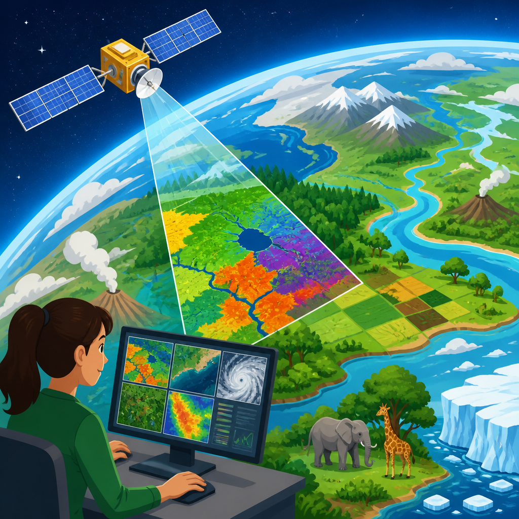
Remote sensing is the science of collecting information about Earth’s surface, atmosphere, and oceans without making direct physical contact, usually through satellites, aircraft, drones, and ground-based sensors. In environmental science, it is one of the most important ways researchers observe change at planetary scale, because it turns light, heat, and reflected energy into usable data about forests, water, climate, agriculture, ice, cities, and biodiversity. I have worked with satellite imagery in environmental reporting and research workflows, and the practical value is unmistakable: remote sensing lets scientists measure places that are too large, dangerous, expensive, or fast-changing to study only from the ground. It matters because modern environmental problems do not stay local. Deforestation in the Amazon affects rainfall patterns beyond Brazil. Melting glaciers alter water supplies and sea level far from mountain valleys. Harmful algal blooms can spread across entire coastlines in days. To understand these processes, researchers need repeated, comparable observations over time, and that is exactly what remote sensing provides.
The term covers several related methods. Passive remote sensing records natural energy, most often sunlight reflected by land or thermal energy emitted by surfaces. Optical satellite images from Landsat and Sentinel-2 are classic examples. Active remote sensing sends out its own signal and measures the return; radar and LiDAR fit this category. Synthetic aperture radar can see through clouds and work at night, while LiDAR measures elevation and vegetation structure with remarkable precision. Resolution is another key concept. Spatial resolution describes pixel size, temporal resolution describes how often an area is revisited, spectral resolution describes how narrowly a sensor separates wavelengths, and radiometric resolution describes sensitivity to energy differences. These terms matter because every environmental question depends on matching the right sensor to the right scale. A wildfire scar, a methane plume, a coral bleaching event, and urban heat islands all require different combinations of frequency, detail, and spectral capability.
As a hub for research and discoveries in environmental science, remote sensing sits at the center of modern evidence building. It supports basic science, public policy, conservation management, disaster response, and corporate accountability. It also connects to related topics readers often search for, including climate change monitoring, biodiversity mapping, land use change, water quality assessment, precision agriculture, and natural hazard detection. The core idea is simple: by reading energy patterns from above, scientists can infer conditions on the ground with speed and consistency. The deeper truth is more powerful. Remote sensing creates historical records, reveals hidden patterns, and enables comparisons across regions and decades that would otherwise be impossible. When people ask how we know forests are shrinking, coastlines are eroding, glaciers are retreating, or cities are overheating, remote sensing is often the answer.
How remote sensing works in environmental research
Every remote sensing system follows the same basic chain: an energy source interacts with a target, the sensor records the returned signal, analysts process the data, and researchers interpret the result against field observations. In practice, that chain can become highly technical. Sunlight may strike a crop field, with chlorophyll absorbing red light and reflecting near-infrared light; a multispectral sensor detects that contrast, and analysts convert it into vegetation indices such as NDVI, the normalized difference vegetation index. A radar system may emit microwave pulses toward a wetland, then measure changes in backscatter caused by water content, roughness, or vegetation density. A thermal sensor may record emitted heat from pavement and tree canopy to map urban heat exposure block by block. The science depends on physics, but the outcome is usable environmental intelligence.
Good research does not rely on imagery alone. The most reliable studies combine remote sensing with field sampling, weather records, hydrological models, biodiversity surveys, or laboratory measurements. That cross-checking process, often called ground truthing or validation, determines whether a map reflects reality. For example, a satellite may indicate probable mangrove loss, but researchers still verify species composition and disturbance causes on site. In my experience, the strongest findings come from this combination of broad coverage from above and precise measurement on the ground. Open data has made this approach more accessible than ever. NASA and the USGS provide Landsat archives stretching back to the 1970s, the European Space Agency offers Sentinel imagery, and platforms such as Google Earth Engine allow large-scale analysis without requiring researchers to download massive datasets locally.
Major remote sensing tools and what they reveal
Different sensors answer different environmental questions, and understanding their strengths is essential for interpreting research. Optical imagery is the most familiar, because it resembles photography, but it can reveal much more than visible color. Multispectral sensors detect wavelength bands beyond human vision, helping identify vegetation stress, burn severity, suspended sediment, snow cover, and shallow water features. Landsat is especially valuable for long-term environmental change because it offers a continuous, standardized record across decades. Sentinel-2 adds frequent revisits and fine spectral bands useful for agriculture, wetlands, and coastal studies.
Radar is indispensable where cloud cover blocks optical imagery. In tropical forests and during storms, synthetic aperture radar often delivers the only reliable observations. It is used to track flood extent, detect illegal logging roads, monitor sea ice, and measure ground deformation linked to earthquakes or subsidence. LiDAR is different again. By timing laser returns, researchers build highly accurate three-dimensional models of terrain and vegetation. Airborne LiDAR has transformed forest science by estimating canopy height, biomass, and habitat complexity. Thermal sensors support studies of drought, wildfire behavior, irrigation efficiency, and heat vulnerability in cities. Hyperspectral instruments, which collect hundreds of narrow bands, can distinguish mineral types, plant chemistry, coral health, and contamination patterns that broader sensors might miss.
| Sensor type | Main signal | Best uses | Common limitations |
|---|---|---|---|
| Optical multispectral | Reflected sunlight | Land cover, vegetation, water color, burn scars | Clouds, smoke, nighttime darkness |
| Thermal infrared | Emitted heat | Surface temperature, drought stress, urban heat | Coarser resolution, atmospheric interference |
| Radar | Returned microwave signal | Floods, forest structure, ice, deformation | Complex interpretation, speckle noise |
| LiDAR | Laser return timing | Elevation, canopy height, biomass, terrain mapping | Higher cost, limited repeat coverage |
| Hyperspectral | Many narrow reflected bands | Species traits, minerals, pollution, reef condition | Large data volumes, advanced calibration needs |
Climate change, ecosystems, and pollution monitoring
Remote sensing matters for the planet because it provides direct evidence of environmental change at scales that matter for decision-making. Climate research depends on satellite observations of sea surface temperature, atmospheric gases, ice sheet elevation, snow cover, wildfire emissions, and changing vegetation patterns. Agencies such as NASA, NOAA, ESA, and the World Meteorological Organization rely on these records to detect trends, validate climate models, and assess extremes. The retreat of Arctic sea ice, for example, is tracked with satellite data because no ship-based program could measure the entire region with comparable consistency. Glacier mass loss, coastal inundation risk, and drought severity are all documented through repeated observations from space and air.
Ecosystem science has been equally transformed. Researchers map deforestation in near real time using systems such as Global Forest Watch and Brazil’s DETER alerts. Wetland loss, peatland drying, coral bleaching, and grassland degradation can be monitored across large and remote landscapes. Biodiversity itself is not directly visible from orbit in the way a tree or lake is, yet remote sensing captures habitat structure, moisture, fragmentation, and seasonal productivity that strongly influence species survival. Pollution research also benefits. Satellites now detect nitrogen dioxide over cities, aerosols from wildfire smoke, sediment plumes at river mouths, and methane emissions from oil and gas infrastructure. Recent methane-detection missions have made individual super-emitters visible, changing how regulators and journalists investigate industrial leaks.
Disasters, food systems, and water security
Some of the clearest public benefits of remote sensing appear during disasters. Flood maps derived from radar can be produced even when storms block visible imagery, helping emergency managers identify isolated communities and prioritize rescues. Wildfire analysts use thermal anomalies and burn severity maps to direct suppression, estimate ecological damage, and model post-fire erosion risks. After hurricanes, cyclones, landslides, and volcanic eruptions, satellite imagery becomes a common operating picture for governments, insurers, and humanitarian organizations. The speed of access matters as much as the data itself. A delayed image may be useful for assessment, but a near-real-time image can save lives.
Agriculture and water management are another major research frontier. Remote sensing supports precision agriculture by showing crop vigor, irrigation performance, pest stress, and field variability. Evapotranspiration models built from thermal and meteorological data help estimate how much water crops actually use. In water-scarce regions, these methods are critical for balancing farm productivity with aquifer protection. Reservoir levels, snowpack, watershed change, and harmful algal blooms are also monitored from above. During drought, satellites reveal not just where rainfall is low, but where vegetation is failing, soils are drying, and heat stress is intensifying. For countries with limited ground stations, remote sensing often provides the only consistent regional picture of water security.
Limits, ethics, and the future of discovery
Remote sensing is powerful, but it is not magic. Images can be misread when analysts ignore seasonality, topography, sensor bias, or atmospheric effects. A bare field after harvest may resemble degradation if timing is wrong. Cloud contamination can distort trends. Coarse pixels can hide local inequalities, especially in urban neighborhoods or fragmented habitats. Many environmental variables are inferred rather than directly measured, so uncertainty must be reported honestly. That is why strong studies publish methods, validation statistics, classification accuracy, and known limitations. Open reproducible workflows, especially those built in Python, R, QGIS, ArcGIS, and Google Earth Engine, have improved transparency, but careful interpretation still matters more than software choice.
There are ethical questions as well. High-resolution imagery can support conservation and disaster response, yet it can also raise concerns about surveillance, land rights, and unequal access to information. Indigenous communities, smallholder farmers, and coastal residents may be mapped extensively without being included in how data is interpreted or used. The best environmental research treats remote sensing as a tool for informed collaboration, not distant observation alone. Looking ahead, the field is moving toward higher revisit rates, better methane and biodiversity indicators, more small satellites, stronger integration with machine learning, and tighter coupling between satellite, drone, and in situ data. For anyone following research and discoveries in environmental science, remote sensing is foundational. It helps humanity see the planet clearly, compare change over time, and act on evidence rather than assumption. If you want to understand environmental science more deeply, start with remote sensing and then explore the connected topics it informs across climate, ecosystems, water, and resilience.
Frequently Asked Questions
What is remote sensing in simple terms?
Remote sensing is the process of gathering information about Earth without physically touching the place being measured. Instead of standing in a forest, crossing an ocean, or digging into a glacier everywhere you want data, scientists use sensors mounted on satellites, airplanes, drones, and ground-based instruments to detect energy reflected or emitted from the surface and atmosphere. That energy may include visible light, infrared radiation, thermal heat, or microwave signals, and each type reveals something different about the planet.
In practical terms, remote sensing turns patterns of light and energy into maps, measurements, and time-based records. Researchers can use it to see where forests are healthy or stressed, how much water is stored in lakes and wetlands, how cities are expanding, where crops are thriving, or how ice cover changes from season to season. Because these observations can be repeated regularly over large areas, remote sensing gives scientists a consistent way to monitor change across regions, countries, and the entire globe. That is what makes it so powerful in environmental science: it allows us to understand Earth as a connected system rather than as isolated locations.
How does remote sensing actually work?
Remote sensing works by detecting how objects and surfaces interact with energy. The Sun is the most common energy source for many remote sensing systems. Sunlight reaches Earth, and different materials such as vegetation, soil, water, snow, and concrete reflect and absorb that light in distinct ways. Sensors measure those differences and record them as data. For example, healthy plants reflect near-infrared light more strongly than stressed plants, which allows scientists to assess vegetation condition, crop growth, and habitat change.
Not all remote sensing depends only on sunlight. Thermal sensors measure heat emitted by Earth’s surface, which helps identify wildfires, urban heat islands, drought stress, and ocean temperature patterns. Radar systems actively send microwave signals toward the ground and measure the return signal, making it possible to collect information day or night and often through clouds. This is especially useful in tropical regions, disaster zones, and areas with frequent cloud cover. After the raw measurements are collected, scientists process and interpret them using calibration, image analysis, geographic information systems, and field validation to convert sensor readings into useful environmental information.
Why is remote sensing so important for the planet?
Remote sensing matters because many of the biggest environmental challenges happen across vast areas and change continuously over time. Climate change, deforestation, melting ice, sea-level rise, drought, flooding, habitat loss, and agricultural stress cannot be fully understood through local observations alone. Remote sensing provides the wide-angle, repeatable view needed to track these changes at the scales where they actually unfold. It helps scientists move from scattered measurements to global evidence.
Its importance also comes from speed, coverage, and consistency. Satellites can revisit the same place again and again, creating long-term records that reveal trends invisible in a single snapshot. Researchers can compare current conditions with observations from years or decades earlier to understand whether a forest is recovering, a coastline is eroding, or a city is heating up. Remote sensing also supports decision-making. Governments, conservation groups, farmers, emergency managers, and climate researchers use these data to plan responses, protect resources, and prioritize action. In other words, remote sensing does not just help us observe the planet; it helps us manage and protect it more intelligently.
What can remote sensing be used for in environmental science?
Remote sensing has a remarkably broad range of environmental applications because different sensors can detect different characteristics of land, water, ice, vegetation, and atmosphere. In forestry, it is used to map tree cover, estimate biomass, detect logging, monitor wildfire damage, and track regrowth after disturbance. In agriculture, it helps assess crop health, irrigation needs, planting patterns, and drought impacts. In hydrology, scientists use it to monitor rivers, reservoirs, wetlands, soil moisture, snowpack, and flood extent. In ocean and coastal science, it can reveal sea surface temperature, harmful algal blooms, shoreline change, sediment plumes, and coral reef stress.
It is equally important for climate and biodiversity research. Scientists use satellite records to study glacier retreat, polar ice loss, desertification, urban expansion, air pollution, and changes in ecosystems over time. Remote sensing can help identify critical habitats, monitor fragmentation, and detect environmental pressures in places that are difficult to access on the ground. It is also essential in disaster response, where rapid imagery can show the extent of fires, storms, landslides, or flooding shortly after an event. Because remote sensing can cover remote, dangerous, or politically difficult areas, it expands what environmental science can realistically measure and monitor.
Are there any limits or challenges to remote sensing data?
Yes, and understanding those limits is important. Remote sensing is incredibly valuable, but it is not the same as direct observation in the field. Sensors measure energy, not environmental meaning by themselves. That means researchers must interpret the signals carefully. Cloud cover can block optical satellite imagery, smoke can reduce visibility, shadows can complicate land-cover analysis, and coarse spatial resolution may miss fine-scale features. Different sensors also vary in timing, wavelength sensitivity, revisit frequency, and accuracy, so the choice of data source depends on the question being asked.
Another challenge is that remote sensing works best when paired with ground truth. Field measurements, local expertise, and in-place monitoring stations are often needed to validate what satellite or airborne data appear to show. For example, an image may indicate vegetation stress, but field observations may be necessary to determine whether the cause is drought, pests, disease, or land management changes. Processing and interpreting remote sensing data also require technical skill, careful quality control, and awareness of uncertainty. Even with those limitations, remote sensing remains one of the most effective tools ever developed for observing planetary change, especially when it is combined with on-the-ground science and long-term environmental monitoring.